Maruyama Senmaida: 1,340 Preserved Stepped Rice Terraces in the Kii Mountain Range
Tucked on a steep valley slope in Kumano's Kii Mountains, 1,340 miniature rice plots supported by medieval dry-stone retaining walls stair-step across a 160-meter drop.
Field Warnings & Critical Traps to Avoid
Transit connections, seasonal operating restrictions, and on-site etiquette reminders.
Extremely Narrow Single-Lane Mountain Road Route 40
The winding mountain roads approaching Maruyama Senmaida from Kumano have frequent single-lane bottlenecks with blind curves. Yield to local agricultural trucks and use roadside pullouts patiently.
Zero Public Bus Service Directly to the Terraces
No public bus climbs directly into the Maruyama Senmaida basin. Ride the Kumano City Community Bus (Kumano Kodo Seiryuso Line, ~31–35 mins, 400 JPY) to "Senmaida · Tori-toge Iriguchi" on Route 311 and walk uphill 30–40 minutes (~1.7 km), or arrange a taxi from JR Kumanoshi Station.
Strict Ban on Stepping Onto Fragile Agricultural Bunds
The ancient stone dykes (Nozura-zumi) date from the Muromachi period and are easily loosened. Walk strictly on the paved public farming lanes; never walk across rice plots or farmers’ private stone stairs uninvited.
Resting on the southwest slope of Mt. Shirakura in Kiwa-cho, Kumano City, Mie Prefecture, Maruyama Senmaida packs 1,340 miniature rice terraces across a steep mountain amphitheater with a 160-meter elevation drop. Travelers generally view the valley from two distinct spots: the accessible Route 40 Senmaida Observation Deck halfway up the slope, and the higher Tori-toge Observation Deck reached by climbing 175 wooden steps along the Kumano Kodo Kitayama-do trail (note: Fuden Pass lies over 3.4 km away across a ridge and has no line of sight to the terraces).
The land’s documented history stretches back more than four centuries: a 1601 feudal land survey (Keicho 6) recorded 2,240 cultivated plots here. To stabilize the gradient without mortar, farmers built dry-stone retaining walls (nozura-zumi) out of unhewn local boulders, leaving natural gaps so mountain springs and heavy typhoon rains could drain safely behind the stones. Rural depopulation shrank the active plots to just 530 by the early 1990s until local residents formed a preservation association in 1993 and Kumano City passed its 1994 conservation ordinance, launching an urban foster-owner program (owner system) that brought the terraces back to 1,340 plots—the smallest barely 0.5 square meters in size.
From JR Kumanoshi Station (served by JR Limited Express Nanki HC85 trains), driving via National Route 311 and single-lane Prefectural Route 40 takes about 30 minutes. Non-drivers can board the Kumano City Community Bus (Kumano Kodo Seiryuso Line, 31–35 mins, 400 JPY) to “Senmaida · Tori-toge Iriguchi” on Route 311 and walk 30–40 minutes (~1.7 km) uphill. Late May brings flooded paddies reflecting morning and sunset light just before rice planting, followed in early June by the dusk Mushi Okuri ritual lighting 1,340 candles and torches along the ancient stone walls.
Step-by-Step Visual Route & Timestamps
Follow our exact on-the-ground walking pace and timestamps. Click any photo or stop title to open rich multi-photo galleries, field tips, and expanded logistical guides.
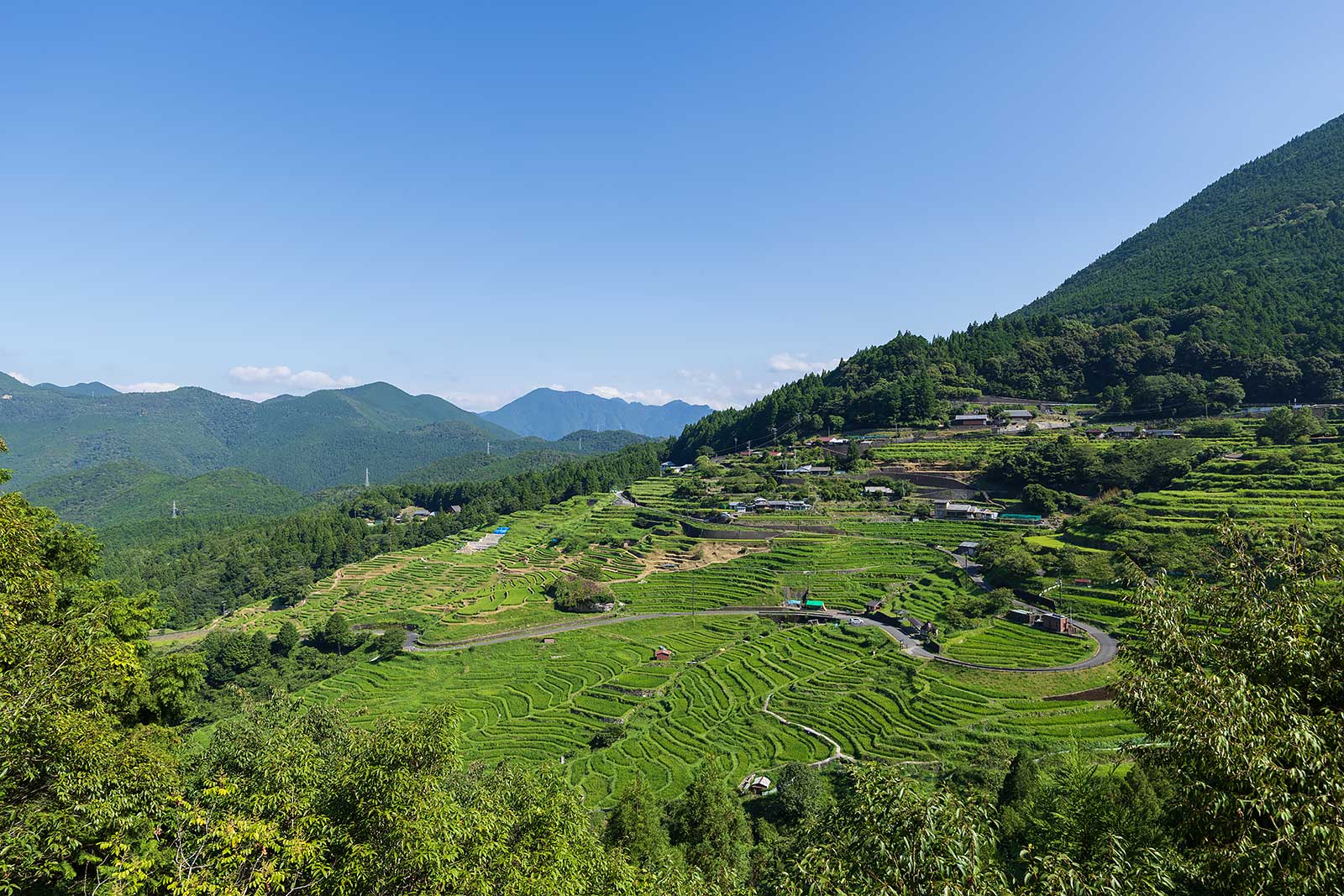
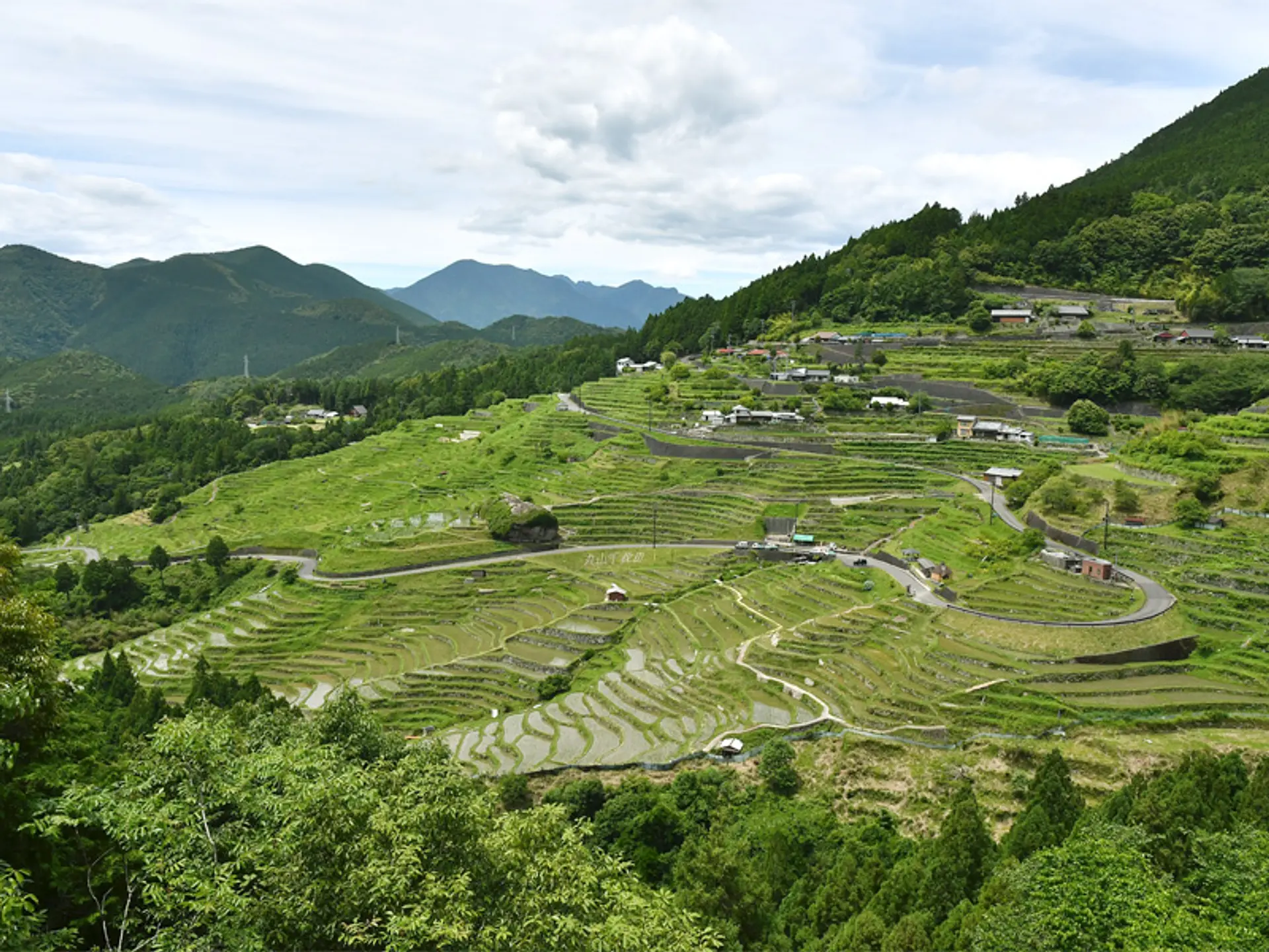
Roadside view from Prefectural Route 40 showing summer-green stepped paddies, farmhouses, and the looping asphalt lane. · Photo: 丸山千枚田保存会 公式サイト
Begin at the roadside observation deck along Prefectural Route 40 on the southwest slope of Mt. Shirakura. From here you see 1,340 small paddies stepping across a 160-meter vertical drop alongside the looping asphalt farm lanes and clustered slate-roofed farmhouses.
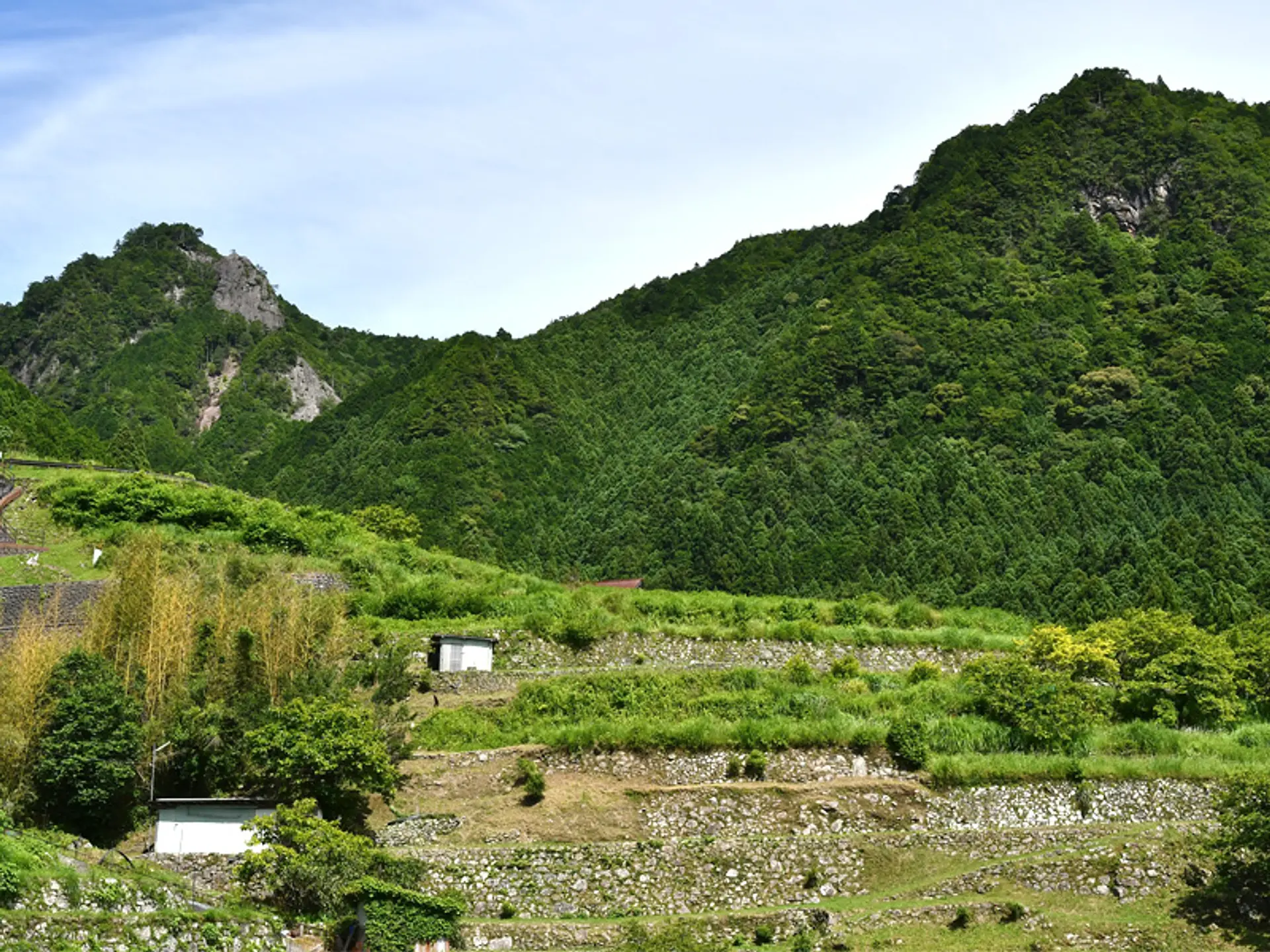
Stacked nozura-zumi stone retaining walls climbing toward the forested ridge and exposed rock peak of Mt. Shirakura. · Photo: 観光三重 公式写真ギャラリー
Walk down the paved public farming tracks into the lower terraces to view unhewn sandstone boulders stacked without mortar ("nozura-zumi"), paired with stone drainage channels that keep spring water flowing from the upper slopes without washing out the soil.
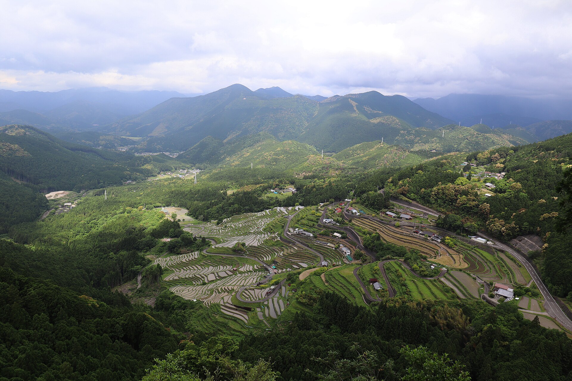
High-altitude view from Tori-toge Observation Deck capturing all 1,340 flooded plots, farmhouses, and Route 40 winding along the ridge. · Photo: Reggaeman (CC BY-SA 4.0)
Follow the Kumano Kodo Kitayama-do trail to the Tori-toge Pass junction and climb the 175 wooden steps to the high summit deck. Alongside the 1994 restoration monument, trace how 2,240 paddies in 1601 shrank to just 530 in the early 1990s before the 1994 conservation ordinance and urban foster program restored 1,340 plots—the smallest measuring roughly 0.5 square meters.
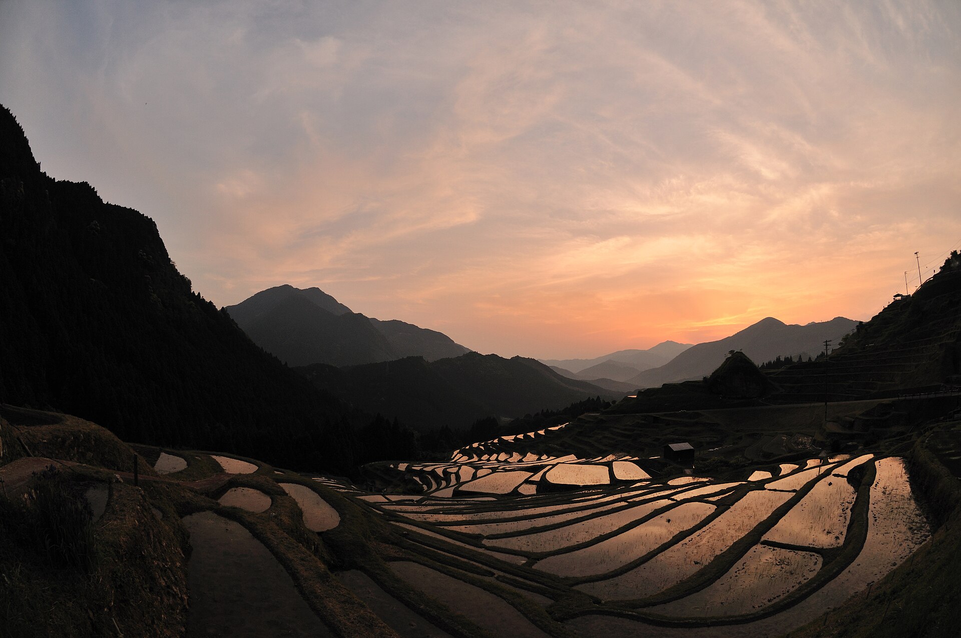
Warm sunset glow reflecting across dozens of stepped stone-walled rice plots against dark Kii Mountain silhouettes. · Photo: Reggaeman (CC BY-SA 4.0)
Return to the mid-slope stone lanes before sunset as the western sky over the Kii Mountains turns amber and magenta across the flooded terraces. If visiting in early June, stay past dusk for the annual Mushi Okuri ritual, when villagers and terrace foster owners light 1,340 candles and torches along the stone bunds to ward off crop pests.
Interactive Location & Route Map
Many rural Asian landmarks don’t appear when searching English spellings in Google Maps. Click any numbered stop on the map below or tap the button above to open the exact latitude/longitude pin on your phone.
Frequently Asked Questions
When is the best time of year to photograph the water reflection?
From mid-May to early June. During this window, farmers flood the rice paddies with mountain spring water just before planting seedlings, turning all 1,340 stepped stone plots into shallow reflecting pools for morning and twilight skies.
What is the "Mushi Okuri" fire festival at Maruyama Senmaida?
Held annually in early June, the traditional Mushi Okuri festival sees 1,340 candles and hand-held torches lit along the stone terraces after sunset to pray for pest-free harvests, tracing the curved contours of the entire hillside in warm candlelight.
Field Verification & Non-Sponsored Standards
This travel dispatch was researched exclusively through public transport (trains, local branch buses, ferries) and foot exploration. Uncharted Asia accepts zero commercial sponsorships, free stays, or sponsored meals. Timetables, fare gates, and mountain trail conditions are independently verified against physical operator timetables. Learn more in our Editorial Methodology.