Kiso Valley Nakasendo Trail: Walking the Edo Highway from Magome to Tsumago
Walk the eight-kilometer forest footpath connecting Magome-juku and Tsumago-juku along Japan’s Edo-period mountain highway past waterwheels, bronze bear bells, and free Irori tea resthouses.
Field Warnings & Critical Traps to Avoid
Strict 11:30 AM seasonal baggage cutoff, Asiatic black bear bells, and 16:45 final Nagiso bus.
Seasonal Baggage Delivery Only Operates Late March to Nov 30 (Closes 11:30 AM)
Official tourist-desk luggage forwarding (1,000 JPY per bag between Magome and Tsumago) operates strictly from late March through November 30, with morning drop-off open ONLY from 08:30 to 11:30 AM. Outside that window or during winter suspension, haul backpacks personally or forward suitcases ahead via Yamato Takkyubin between JR hotel cities.
Asian Black Bear Habitat & Slick Rain-Wet Flagstones on Magome Pass
Forest bends between Magome Pass and Tsumago cross active Asiatic black bear terrain. Ring every wooden-posted brass bear bell firmly around blind curves, rent or carry personal bear bells if hiking quietly, and wear grip-soled trail shoes across wet historic cobblestones (carry traction cleats in winter ice December–March).
Early 16:45 Final Town Bus Out of Tsumago to JR Nagiso Station
Confirm current Tsumago-to-JR Nagiso bus departures immediately on landing or pick up luggage before 17:00 closing. The final afternoon bus commonly departs around 16:45—missing it requires walking ~4 km alongside rural Highway 19 with minimal sidewalks and rare taxi dispatch.
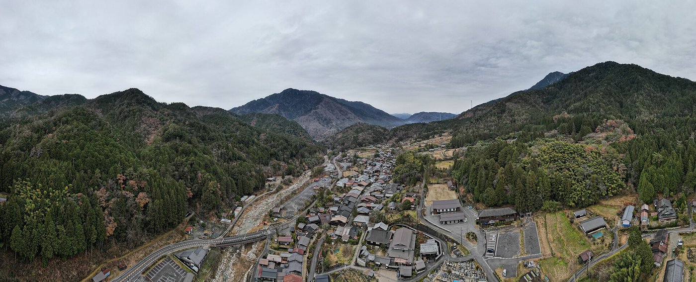
Spanning roughly eight kilometers across the forested provincial divide between Gifu and Nagano Prefectures, the footpath linking Magome-juku and Tsumago-juku preserves the finest uninterrupted stretch of Japan’s 1603 Nakasendo highway. Built inland under Tokugawa Shogunate authority to carry samurai retinues, couriers, and noble travelers cleanly between Edo and Kyoto away from flood-prone coastal rivers, its mossy cobblestones and timber resthouses remain shielded deep in the Kiso Valley far from modern Highway 19.
Always walk south-to-north from Magome (~600 m) to Tsumago (~430 m): riding JR Limited Express Shinano from Nagoya to Nakatsugawa (~50 mins) and transferring 25 minutes by bus up to Magome reduces your uphill work to a brisk 190-meter rise to 790 m Magome Pass (Magome-toge) followed by over 5.5 km of leafy descent. If traveling between late March and November 30, check large packs before 11:30 AM for the 1,000 JPY baggage delivery service to Tsumago (pickup strictly before 17:00; suspended every winter Dec–mid-Mar).
Pause on Magome’s stone slope for warm charcoal-grilled Gohei-mochi brushed in walnut miso glaze, toll brass bear-warning bells before forested curves, accept free hot tea beside the 250-year-old sunken irori hearth inside Ichikokutochi Tateba Tea House (dropping a small donation into the box), detour briefly past Odaki & Medaki twin cascades, and celebrate inside wire-free Tsumago-juku by stamping a 300 JPY Kiso cypress completion plaque well ahead of the ~16:45 final town bus out to JR Nagiso Station.
Step-by-Step Visual Route & Timestamps
Follow our exact on-the-ground walking pace and timestamps. Click any photo or stop title to open rich multi-photo galleries, field tips, and expanded logistical guides.
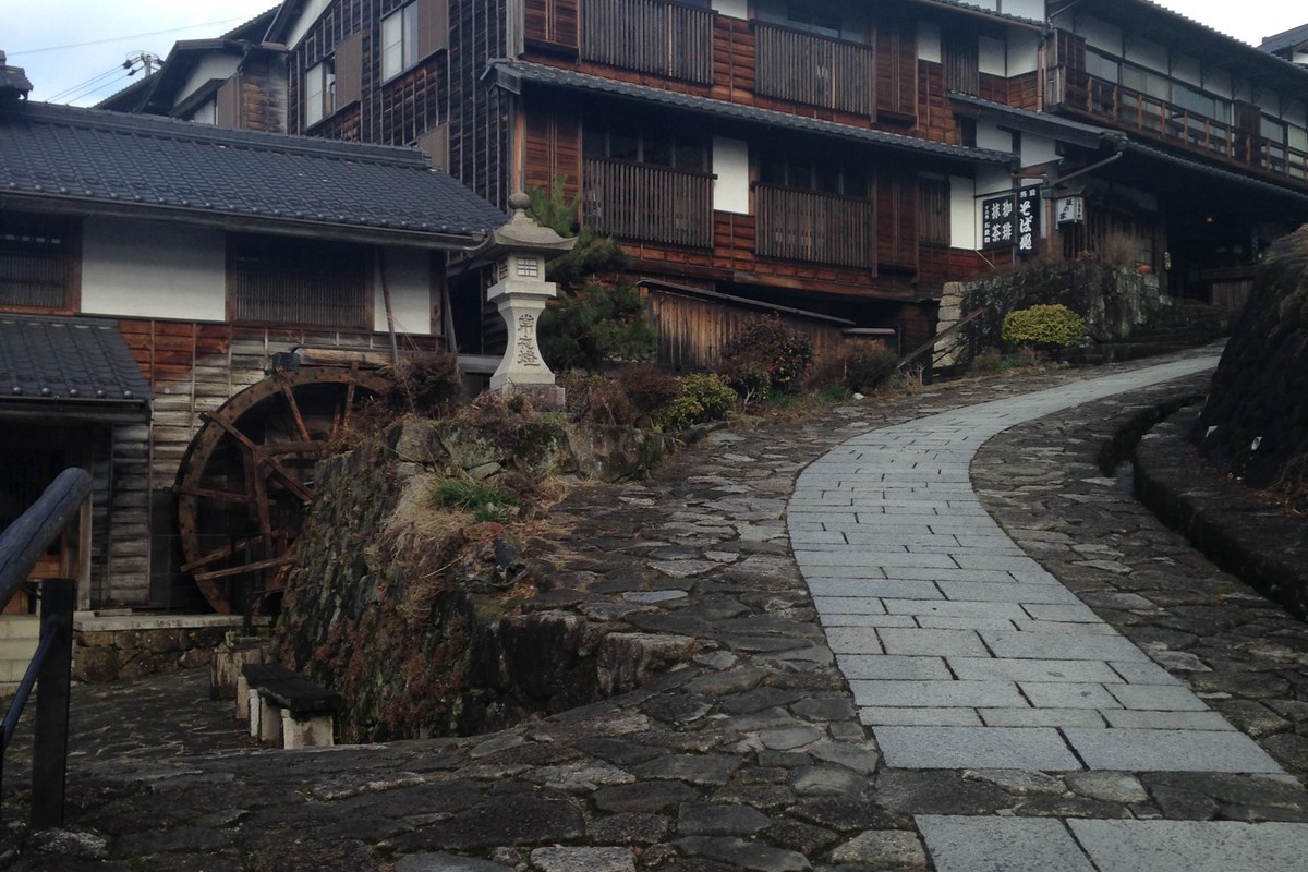
Stepped stone main street and dark wooden lattice facades climbing up Magome-juku post town. · Photo: Wikimedia Commons (CC BY-SA 4.0)
Arrive early by bus from JR Nakatsugawa at Magome-juku (elevation ~600m), historic Post Station No. 43 along the Nakasendo highway. Unlike flat valley stations, Magome climbs a dramatic 600-meter stone-paved slope lined with dark cedar shopfronts, waterwheel flumes, and sweeping views toward Mount Ena—check bags at the info center before heading upward toward the pass.

Freshly charcoal-toasted Gohei-mochi rice skewers glazed in crushed walnuts, sesame, and miso along Magome street. · Photo: Wikimedia Commons (CC BY-SA 4.0)
Fuel up halfway up Magome's wooden lane at open charcoal braziers grilling Gohei-mochi—hand-pounded upland rice cakes pressed onto flat cedar paddles, basted in thick roasted walnut, black sesame, and sweet red miso glaze, and seared crisp right over binchotan embers for ~250–300 JPY a skewer.
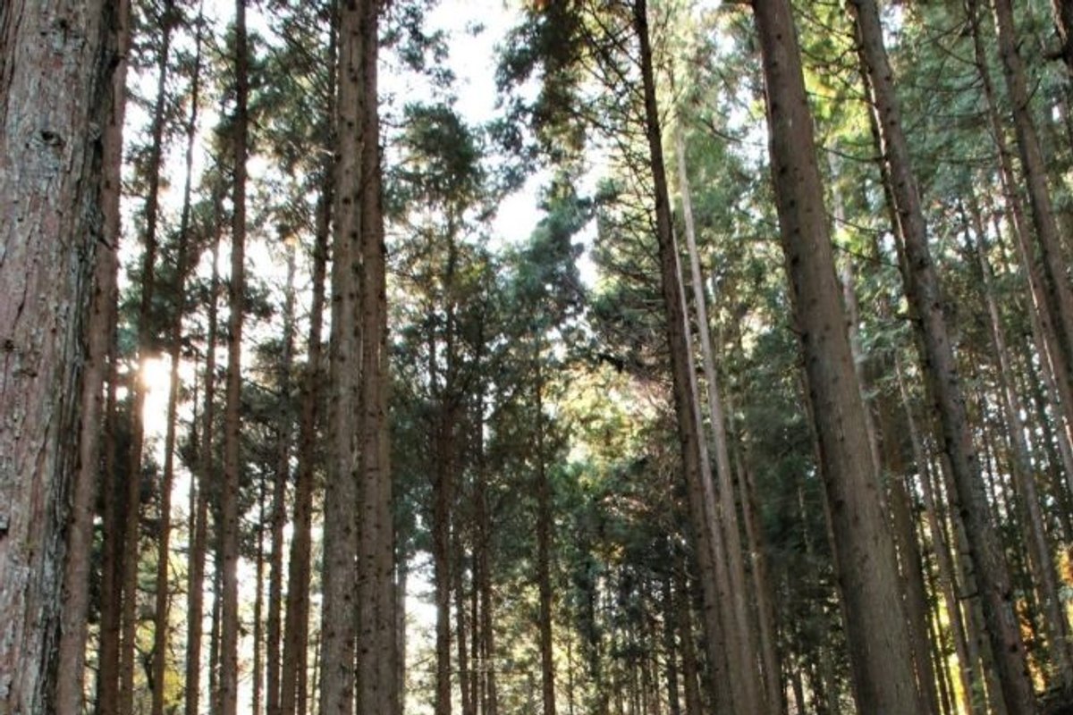
Original mossy Edo flagstone trail winding cleanly beneath towering Kiso cedars approaching Magome Pass. · Photo: Wikimedia Commons (CC BY-SA 4.0)
Step past the final Magome farmhouses directly onto mossy Edo-period granite cobblestones ("ishidatami") winding upward through tall cryptomeria cedars and dense bamboo thickets to the 790-meter Magome Pass ("Magome-toge"), the historical provincial line dividing Mino (Gifu) and Shinano (Nagano). Ring each brass bear-warning bell standing beside blind forest curves.
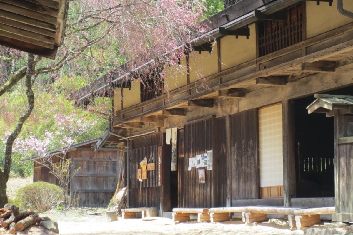
Preserved 18th-century timber structure of Ichikokutochi Tateba Tea House beside the Nakasendo descent. · Photo: Wikimedia Commons (CC BY-SA 4.0)
Descending the northern cedar slope out of Magome Pass leads directly past Ichikokutochi Tateba Tea House—a surviving 250-year-old timber rest station and Edo forestry guard post. Step inside across worn floorboards to warm hands beside its smoldering central sunken irori hearth, where volunteer village caretakers ladle free hot green tea from suspended iron kettles.
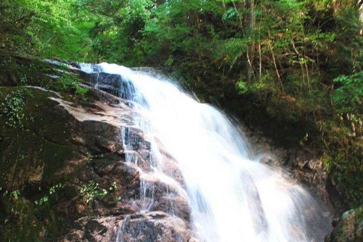
Cold clear flow of Odaki (Male Waterfall) dropping past mossy granite ledges along the Nakasendo detour. · Photo: Wikimedia Commons (CC BY-SA 4.0)
Halfway down through quiet cypress gullies below Otsumago approaches, take a crisp 3-minute wooden spur walk down to see Odaki (Male Waterfall) and Medaki (Female Waterfall)—a paired cascade tumbling cleanly over dark granite ledges beside moss-covered boulders where folk traditions link swordsman Miyamoto Musashi's quiet retreat.
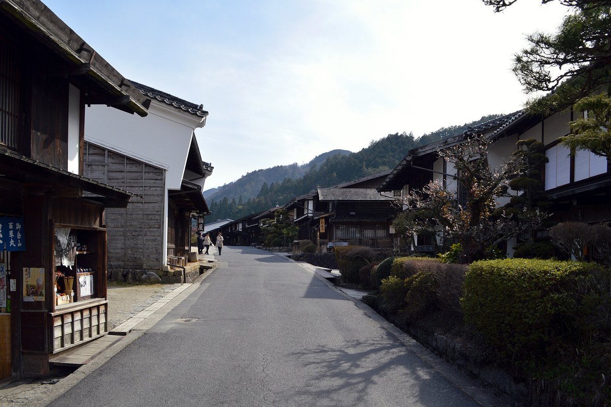
Historic wire-free wooden townhouses and water channels along central Terashita street in Tsumago-juku. · Photo: Wikimedia Commons (CC BY-SA 4.0)
Step off forest dirt directly into Tsumago-juku (Post Town No. 42), the birthplace of Japan's architectural heritage preservation movement. In 1968 villagers agreed cleanly "not to sell, rent out, or destroy" old family buildings—burying overhead power lines underground so weathered Edo inns ("hatago"), wooden shutters, and Honjin gates stand much as they did 250 years ago.
Interactive Location & Route Map
Many rural Asian landmarks don’t appear when searching English spellings in Google Maps. Click any numbered stop on the map below or tap the button above to open the exact latitude/longitude pin on your phone.
Frequently Asked Questions
Is walking Magome -> Tsumago really better than Tsumago -> Magome?
Hiking south-to-north from Magome (~600 m) to Tsumago (~430 m) is strongly preferred by most walkers: it requires only a ~2.2 km / 190 m uphill gain to Magome Pass (790 m) before cruising ~5.5 km cleanly downhill past Tateba Tea House into Tsumago. Reversing from Tsumago forces a long, strenuous ~360 m vertical climb through dense trees.
When does the Magome–Tsumago baggage forwarding service operate?
No—baggage forwarding (1,000 JPY per suitcase/pack) runs ONLY seasonally from roughly late March through November 30 daily, and closes strictly at 11:30 AM for morning drop-off (pick up at the opposite information desk by 17:00). During winter (December to mid-March), forwarding suspends while snow or ice requires traction spikes across Magome Pass.
Field Verification & Non-Sponsored Standards
This travel dispatch was researched exclusively through public transport (trains, local branch buses, ferries) and foot exploration. Uncharted Asia accepts zero commercial sponsorships, free stays, or sponsored meals. Timetables, fare gates, and mountain trail conditions are independently verified against physical operator timetables. Learn more in our Editorial Methodology.