Aogashima Volcano: Tokyo’s Double-Caldera Island in the Philippine Sea
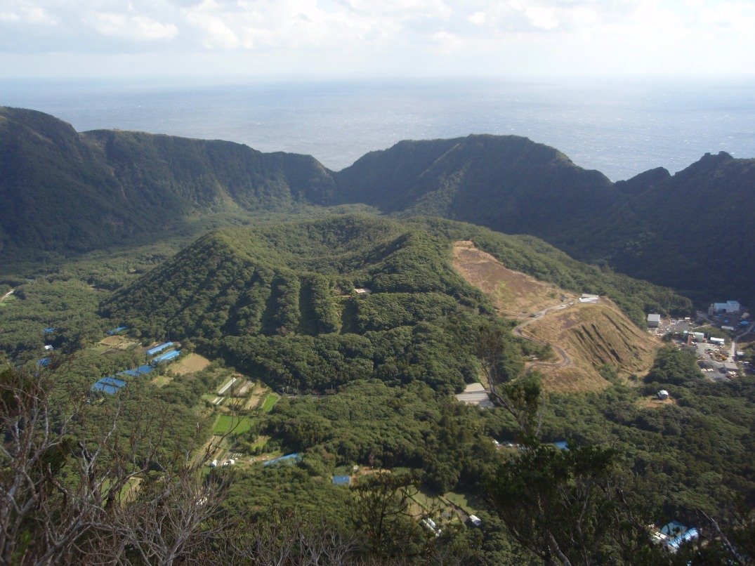
Roughly 358 kilometers south of central Tokyo, a steep volcanic island rises sheer from the ocean, enclosing the inner Maruyama cone inside an outer 1.5-kilometer caldera inhabited by around 160 residents.
Field Warnings & Critical Traps to Avoid
9-seat helicopter competition, cliffside ferry cancellations, and cash prep.
Helicopter Carries Only 9 Seats (Books 1 Month Ahead)
Toho Air's Tokyo Ai-Land Shuttle carries just 9 passengers per flight (11,750 JPY adult one-way; checked luggage over 5 kg incurs 240 JPY/kg). Seats open 1 month prior at 09:00 JST by phone and 12:00 JST online and sell out within minutes.
Aogashima-maru Ferry Cancels Roughly 40–50% of Sailings
Aogashima lacks a natural bay; Aogashima-maru docks alongside an exposed cliff quay at Samboko Port and does not sail Thursdays or Sundays, with over 40–50% weather cancellation rates in rough months. Keep 2–3 buffer days in your Tokyo schedule.
Bring Sufficient Cash & Backup Dry Snacks
There are no convenience stores or ATMs outside the single tiny village Japan Post Bank counter, which keeps short weekday hours and can lose satellite connectivity. Withdraw sufficient JPY cash and buy backup snacks on Hachijojima in case boats cancel for multiple days.
Located roughly 358 kilometers south of Tokyo in the Philippine Sea, Aogashima is the southernmost inhabited island of the Izu Archipelago (5.98 sq km, ~160 residents). Its silhouette rises sheer from the ocean on basalt cliffs between 50 and 200 meters high with zero natural beaches, enclosing a 1.5-kilometer outer caldera around the inner Maruyama cinder cone—a double-caldera structure shaped by the catastrophic 1785 Tenmei eruption, after which islanders evacuated to Hachijojima for five decades before completing the historic Kanju resettlement by 1835.
Reaching the island requires first flying from Tokyo Haneda to Hachijojima (~55 mins), then transferring either to Toho Air’s 9-seat Tokyo Ai-Land Shuttle helicopter (20 mins; 11,750 JPY adult one-way; bookings open 1 month ahead at 09:00 phone / 12:00 web) or the ~3-hour Aogashima-maru ferry operated by Izu Shoto Kaihatsu (~3,470–3,840 JPY cash day-of; no sailings Thursdays or Sundays). Because the concrete quay at Samboko Port faces open ocean swells, ferry reliability drops to roughly 50–60%—always build 2 to 3 weather buffer days into your itinerary, carry sufficient yen cash alongside dry provisions, and note that Fureai Sauna inside the crater opens at 16:00 on weekdays (14:00 on weekends/holidays) and closes every Wednesday.
Step-by-Step Visual Route & Timestamps
Follow our exact on-the-ground walking pace and timestamps. Click any photo or stop title to open rich multi-photo galleries, field tips, and expanded logistical guides.
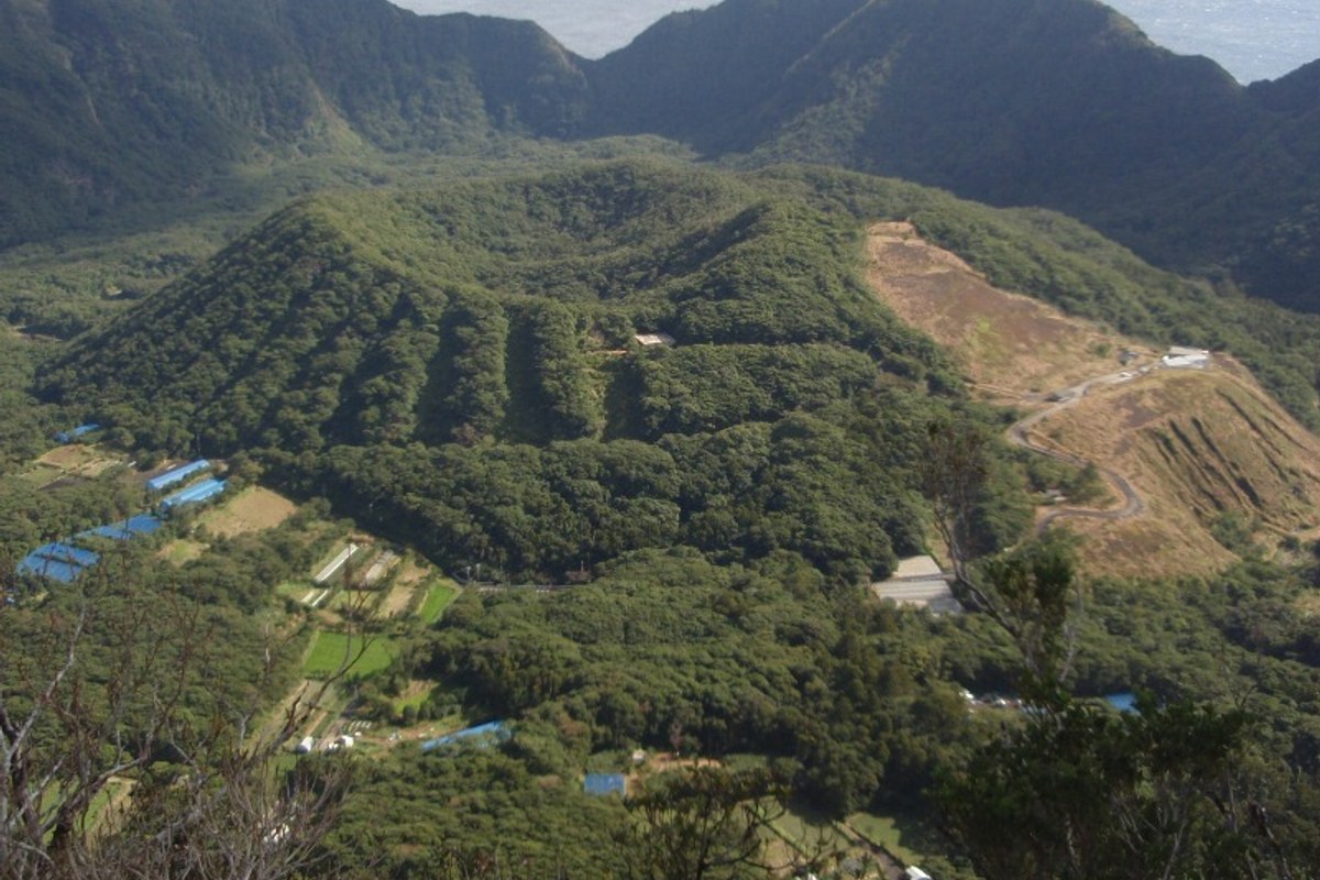
View from Otonbu Peak (423 m) looking down onto the Maruyama inner cone and surrounding caldera cliffs. · Photo: Wikimedia Commons (CC BY-SA 4.0)
Walk the paved stone stairway from the northern plateau village up through subtropical camellias and ferns to Otonbu (423 m), the island's highest point. From the summit platform, the 1.5-kilometer outer caldera rim wraps around the inner Maruyama cinder cone formed in the 1785 Tenmei eruption.
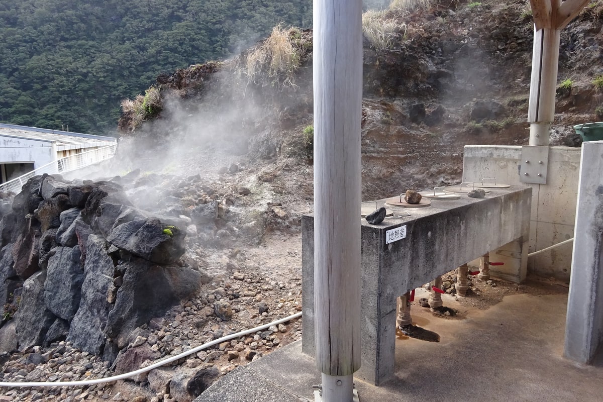
Public geothermal steam cooking ovens at Hingya inside the Ikenosawa crater basin. · Photo: Wikimedia Commons (CC BY-SA 4.0)
Descend into the inner caldera basin of Ikenosawa, where volcanic steam vents—locally called hingya—release natural vapor through stone fissures. At the free public Hingya Cooking Area (Kamado), place raw eggs, sweet potatoes, or sausages bought from the village store into metal steamer pots powered solely by geothermal heat.
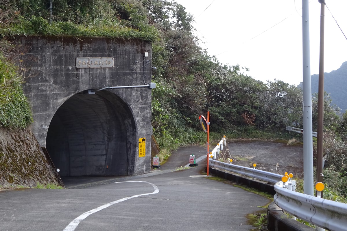
Single-lane tunnel sliced directly through Aogashima's volcanic cliff strata. · Photo: Wikimedia Commons (CC BY-SA 4.0)
Leave the crater floor through single-lane tunnels cut straight through volcanic tuff and basalt walls, including the Heisei Nagashizaka route and Seiho Tunnel descending toward the western cliffs. Up on the cooler northern plateau sit the village office, Juichiya Shoten store, and Aogashima Post Office—handling mail and the island's sole Yucho ATM.
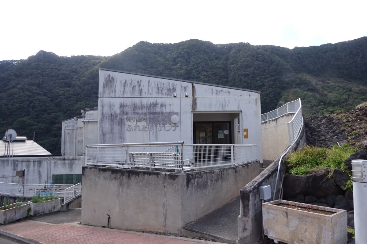
Fureai Geothermal Sauna building inside the Ikenosawa crater basin (300 JPY adult; closed Wednesdays). · Photo: Wikimedia Commons (CC BY-SA 4.0)
Return into the Ikenosawa basin beside the Hingya steam vents for Fureai Sauna (300 JPY adult), a village bathhouse heated directly by natural underground geothermal steam without boilers. Open 16:00–20:00 on weekdays and 14:00–20:00 on weekends and national holidays (last entry 19:00; closed Wednesdays).
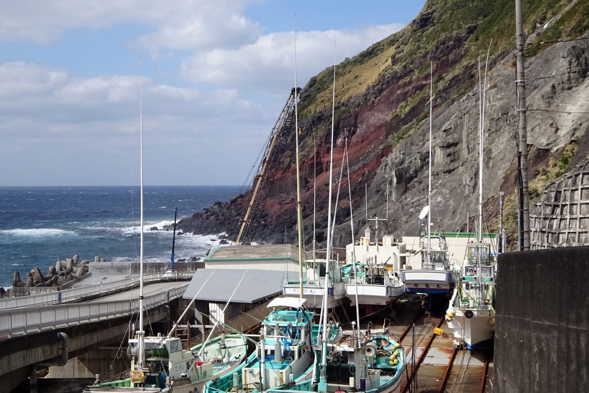
Small boats winched onto the high concrete boat ramp at Samboko Port to protect them from open-ocean swells. · Photo: Wikimedia Commons (CC BY-SA 4.0)
End the afternoon at Samboko Port on Aogashima's western cliff base, the island's sole landing quay for the Aogashima-maru ferry. Because steep basalt walls drop straight into ocean swells with zero sheltered beach, every local fishing boat must be hoisted clear of the water by fixed gantry cranes onto an elevated concrete ramp after each trip.
Interactive Location & Route Map
Many rural Asian landmarks don’t appear when searching English spellings in Google Maps. Click any numbered stop on the map below or tap the button above to open the exact latitude/longitude pin on your phone.
Frequently Asked Questions
Why is Aogashima so difficult to reach reliably?
Aogashima has no airplane runway. The 9-seat Tokyo Ai-Land Shuttle helicopter from Hachijojima books out within minutes 1 month ahead, while the Aogashima-maru ferry cancels Thursdays, Sundays, and whenever ocean swells prevent safe docking at Samboko Port's exposed cliff wall.
Can visitors camp inside Aogashima's volcanic caldera?
Yes. Free camping is permitted at the designated Ikenosawa Campground inside the crater basin (with basic restrooms and access to the Hingya steam ovens), provided you register beforehand with the Aogashima Village Office and pack all personal trash back off the island.
Field Verification & Non-Sponsored Standards
This travel dispatch was researched exclusively through public transport (trains, local branch buses, ferries) and foot exploration. Uncharted Asia accepts zero commercial sponsorships, free stays, or sponsored meals. Timetables, fare gates, and mountain trail conditions are independently verified against physical operator timetables. Learn more in our Editorial Methodology.