Mount Mitoku Sanbutsuji Nageiredo: Climbing to Japan’s Cliffside Temple
Set inside a sheer volcanic rock hollow at ~520 meters on Mount Mitoku, Heian-era Nageiredo requires a strict minimum of two climbers, footwear checks, and entry between 08:00 and 15:00.
Field Warnings & Critical Traps to Avoid
Entry cutoff hours, two-person rule, pole ban, and wet-weather closures.
Registration Window 08:00–15:00 & Minimum Two Climbers Required
Mountain registration strictly runs from 08:00 to 15:00 (all climbers must descend by 16:30). Solo hikers are never permitted for safety—lone visitors must wait at the entrance hut to pair up with another climber.
Trekking Poles Prohibited & Mandatory Footwear Inspection
Walking sticks and trekking poles are strictly banned to avoid damaging tree roots and to keep both hands free on chains and rock holds (pack everything in a backpack). Worn sneakers, sandals, and spiked boots fail the entrance check, requiring purchase of straw waraji sandals on-site.
Immediate Rain/Snow Closures & Cash-Only Buses
Wet volcanic andesite and agglomerate slabs turn dangerously slick; any rain, morning frost, or winter snow triggers immediate trail closure. Hinomaru buses and Sanbutsuji ticket booths are strictly cash-only (carry at least 5,000 JPY cash).
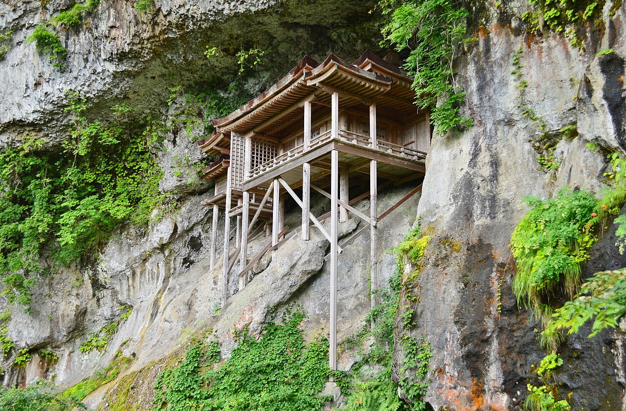
Built inside a vertical recess of volcanic andesite and agglomerate cliffs at roughly 520 meters elevation on Mount Mitoku in Tottori Prefecture, late-Heian Nageiredo (National Treasure) is one of Japan’s most precariously positioned timber halls. Traditional lore credits Shugendo founder En no Gyoja with hurling the shrine into the cliff cavity; structurally, builders trimmed wooden stilts to bespoke lengths so the veranda and cypress-bark roof brace directly against the uneven rock hollow.
Access begins from JR Kurayoshi Station via a ~40-minute Hinomaru Bus ride (~660 JPY, cash only) to the Mitokusan terminus. Because steep root climbs (Kazurazaka) and iron-chain pitches have seen fatal falls, Sanbutsuji enforces strict mountain regulations: registration operates only between 08:00 and 15:00 (descend by 16:30), solo entry is strictly banned (lone travelers must wait to pair up), trekking poles are prohibited so both hands remain free, and every hiker passes a footwear tread inspection (worn shoes require purchasing straw waraji sandals on-site for ~700–1,000 JPY). In rain, frost, or winter snow (typically December through March), the mountain closes without notice—check mitokusan.jp and local weather before setting out.
Step-by-Step Visual Route & Timestamps
Follow our exact on-the-ground walking pace and timestamps. Click any photo or stop title to open rich multi-photo galleries, field tips, and expanded logistical guides.
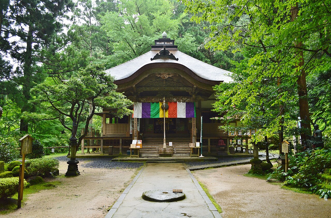
Sanbutsuji Main Hall at the start of the pilgrimage, just below the mountain registration gate. · Photo: Wikimedia Commons (CC BY-SA 4.0)
Climb the mossy stone steps from the parking area to Sanbutsuji Main Hall (400 JPY grounds entry), then register at the mountain entrance hut behind the hall (additional 800 JPY). Rangers inspect boot treads, verify at least two climbers in your party, confirm no trekking poles or shoulder bags are carried, and hand out "Rokkon Shojo" ritual sashes before unlocking the mountain gate.
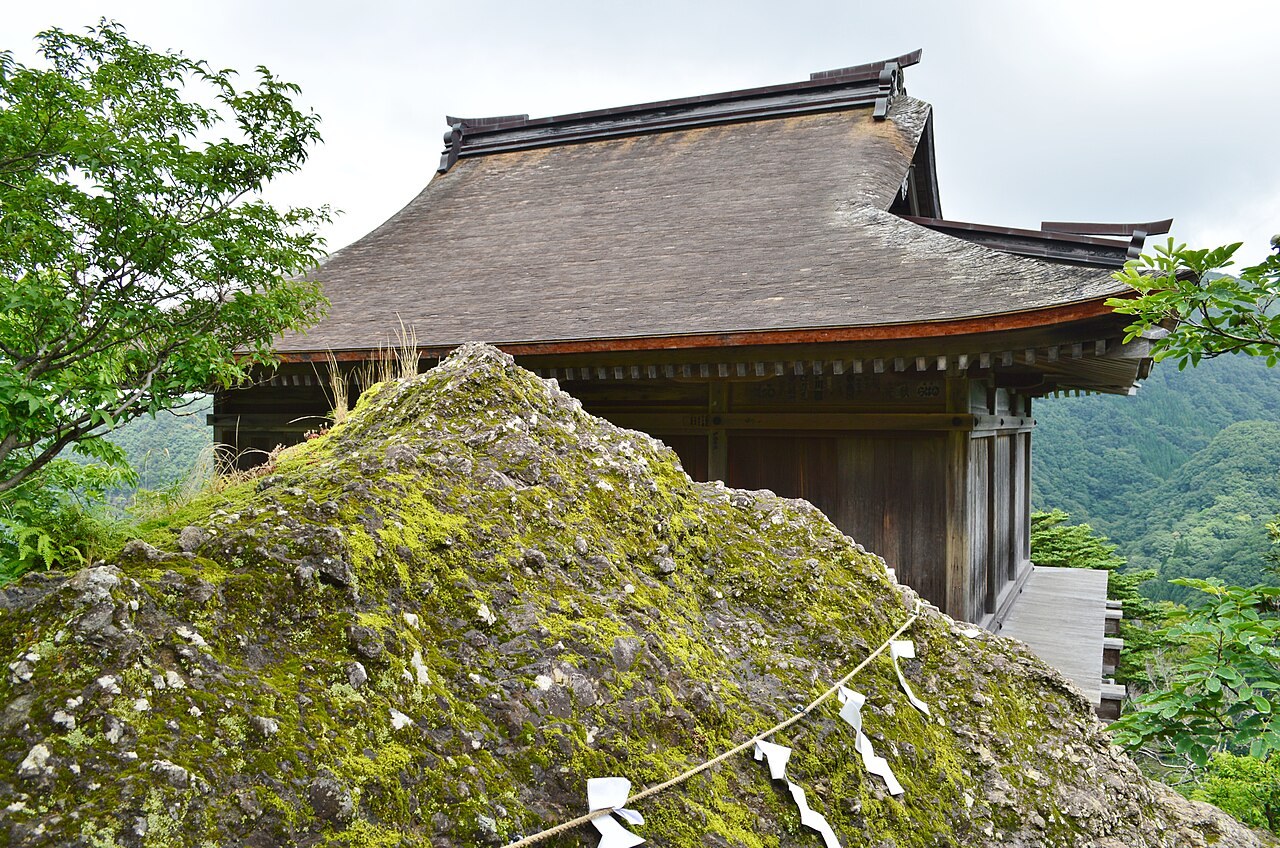
Monju-do (Important Cultural Property) balanced on vertical timber stilts along Mount Mitoku's andesite ridge. · Photo: Wikimedia Commons (CC BY-SA 4.0)
After pulling yourself up the steep exposed tree-root slope of Kazurazaka and the iron-chain rock face of Kusarizaka, emerge onto a narrow volcanic rock crest supporting Monju-do. Remove shoes to step onto its weathered wooden outer veranda—completely without railings—above steep forested gorges overlooking Misasa town.
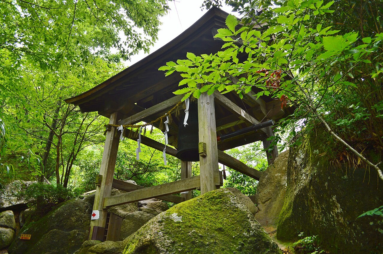
Shoryo-do Bell Tower straddling mossy volcanic rock outcrops along the upper ridge path. · Photo: Wikimedia Commons (CC BY-SA 4.0)
From Monju-do, the trail climbs first to Jizo-do, another cliff-perched wooden hall with a tight veranda, before scrambling the narrow rocky saddle to Shoryo-do Bell Tower. Straddling massive mossy volcanic boulders, the open belfry lets visitors strike the bronze bell echoing across the valley.
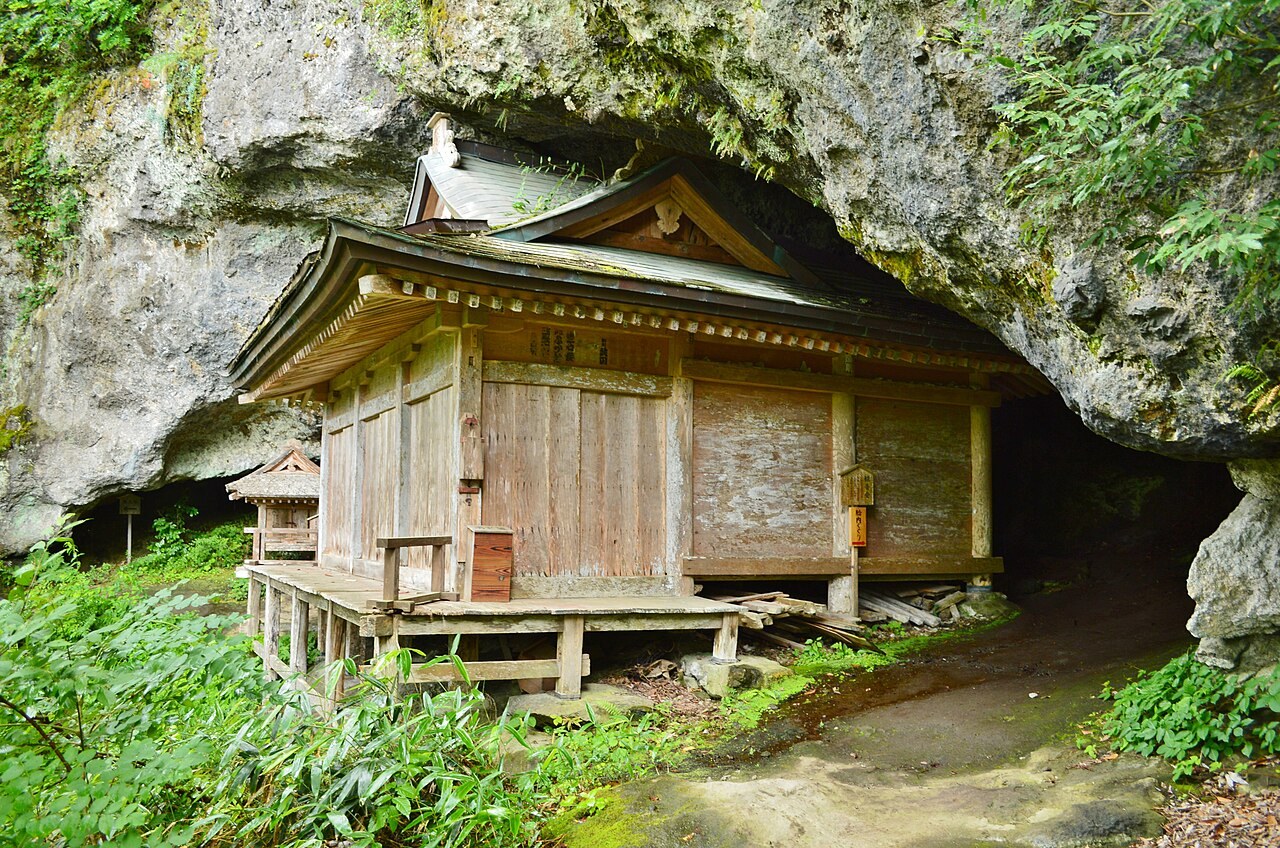
Kannon-do sheltered tightly underneath a curved volcanic rock alcove along the upper cliff trail. · Photo: Wikimedia Commons (CC BY-SA 4.0)
Continuing past Nokyo-do along the cliff face, the path ducks beneath an overhanging volcanic agglomerate cavern housing Kannon-do (where pilgrims can squeeze through the dark inner rock corridor behind the altar—Tainai-meguri) and adjacent Motoyuikake-do, before squeezing up to small cliffside Fudo-do right before the final turn.
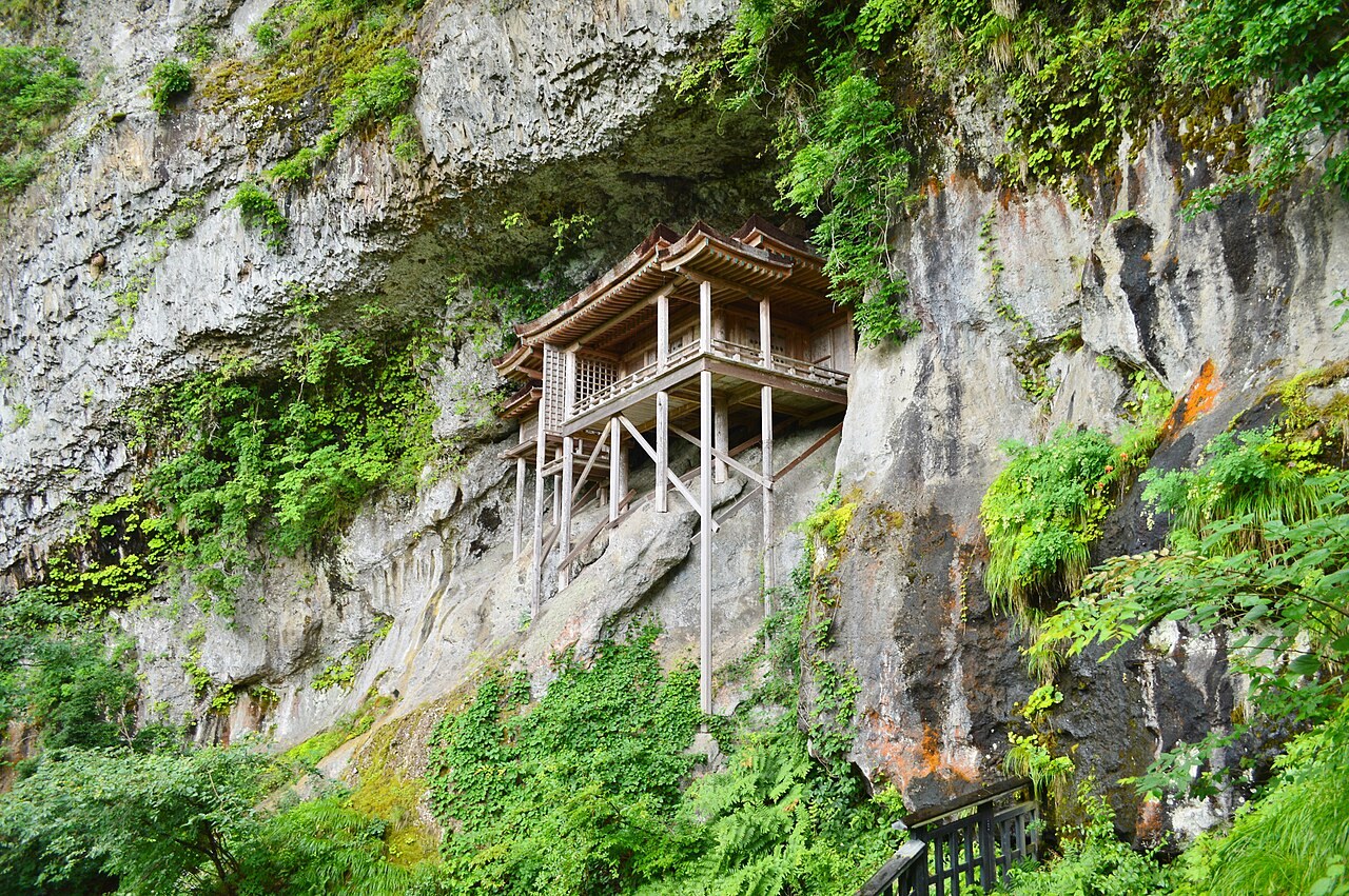
National Treasure Nageiredo viewed from the rocky worship terrace at ~520 meters elevation. · Photo: Wikimedia Commons (CC BY-SA 4.0)
Round the final rock corner to the Nageiredo viewing ledge (elevation ~520 m, roughly 200 m vertical gain from the ~310 m trailhead). Entry into Nageiredo itself is closed to protect the late-Heian National Treasure, yet the cliffside terrace clearly reveals its curved cypress bark roof and stilts fitted onto uneven volcanic rock—echoed earlier along the route by Nokyo-do, Japan's oldest surviving wooden sutra hall.
Interactive Location & Route Map
Many rural Asian landmarks don’t appear when searching English spellings in Google Maps. Click any numbered stop on the map below or tap the button above to open the exact latitude/longitude pin on your phone.
Frequently Asked Questions
Can I climb to Nageiredo alone or carry hiking poles?
Neither is allowed. Temple authorities strictly require at least two people per party—lone hikers must wait at the entrance office to join another traveler. Trekking poles, walking sticks, and loose hand-carried items are banned so both hands remain free on chains and tree roots.
What is the registration deadline and footwear inspection rule?
Mountain registration operates from 08:00 to 15:00 (climbers must return by 16:30), weather permitting. Shoes with worn treads, slick flats, or metal cleats fail inspection, requiring you to buy traditional woven straw waraji sandals (~700–1,000 JPY cash) at the entrance.
Field Verification & Non-Sponsored Standards
This travel dispatch was researched exclusively through public transport (trains, local branch buses, ferries) and foot exploration. Uncharted Asia accepts zero commercial sponsorships, free stays, or sponsored meals. Timetables, fare gates, and mountain trail conditions are independently verified against physical operator timetables. Learn more in our Editorial Methodology.