Sandiaoling Waterfall Trail: Car-Free Three-Tier Gorge & 1922 Pingxi Railway History
Just 55 minutes by TRA Local Train from Taipei Main Station, step directly off tracks onto hiking paths past closed Shuoren miners’ school, three sandstone cascades, cliff rebar ladders, and the 1922 Sandiaoling Eco-Tunnel.
Field Warnings & Critical Traps to Avoid
Steep 70-degree iron ladders, flash-flood stepping pillars, and 48-hour sticky clay mud.
Near-Vertical 70-Degree Cliff Ladders Between Motian & Pipadong Falls
Scaling up past Motian Waterfall onto Pipadong's plateau involves climbing exposed steel rungs bolted onto steep sandstone cliffs alongside hand ropes. Anyone uncomfortable with vertical climbs or hiking with young kids or seniors can safely turn around cleanly right at Motian Waterfall (~85% of trail scenery covered!).
Stream Stepping Pillars Submerge Rapidly During Upstream Downpours
Middle trail links cross shallow creek channels on concrete stepping pillars. Upstream mountain showers can swell ankle-deep water into swift rapids within minutes—turn back right away whenever thunder builds or muddy water reaches step tops.
Sticky Yellow-Red Clay Soil Stays Greasy 48 Hours Past Rain (And Watch Trains!)
Between Shuoren Trailhead and Hegu Overlook, unpaved clay paths hold moisture long after rain clears—avoid smooth white lifestyle sneakers. Similarly, trains still pass regularly beside Sandiaoling Station and tunnel exits: walk strictly inside fenced pedestrian walkways.
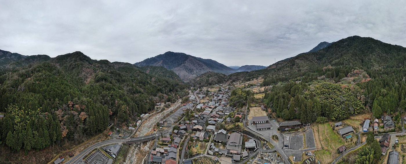
Less than an hour from Taipei Main Station along TRA local tracks, Sandiaoling Station holds a unique distinction on Taiwan’s rail map: zero paved motor roads reach its platform. Wedged tightly between sheer sandstone cliffs and the rushing Keelung River—originally built in 1922 as the splitting junction for the Pingxi coal-mining branch line—walking out along signed trackside walkways quickly trades city traffic for quiet bamboo groves behind the former 1947 Shuoren Elementary School.
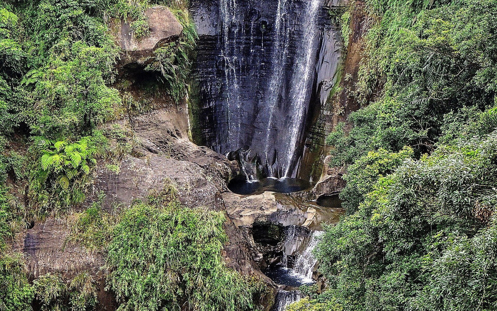
The 2.71-kilometer Sandiaoling Waterfall Trail connects three distinct Daliao Formation sandstone cascades cleanly by rail: broad two-tiered Hegu Waterfall (~25–30 m) framed from a shady gazebo, Motian Waterfall (~41 m) pouring past its hollowed crescent cave overhang beyond twin single-file wire suspension bridges, and uppermost Pipadong Waterfall (~31 m) crowned with deep riverbed potholes. Note that the nearby 1922 Sandiaoling Eco-Friendly Tunnel sits on a separate valley corridor and—unlike the permit-free waterfall trail—requires booking a free timed online slot days in advance.
Always start from Sandiaoling Station and hike upward so you ascend rather than descend backward down the ~70-degree steel rebar cliff ladder leading above Motian (families or anyone wary of heights can turn around comfortably at Motian itself after seeing ~85% of the trail!). Pack grippy lugged boots for clay paths that stay greasy 48 hours after rain, avoid creek crossings if storm runoff clouds water, and bring cash in Taiwan dollars—zero ATMs serve trackside cafes like Cafe Hytte or Uncle Kuan’s when you return.
Step-by-Step Visual Route & Timestamps
Follow our exact on-the-ground walking pace and timestamps. Click any photo or stop title to open rich multi-photo galleries, field tips, and expanded logistical guides.
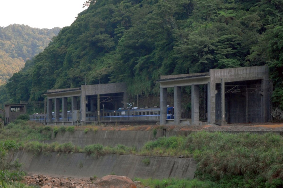
Pedestrian walkway hugging active rail curves above the Keelung River at roadless Sandiaoling Station. · Photo: Wikimedia Commons (CC BY-SA 4.0)
Step onto the narrow concrete platform at Sandiaoling Station—the sole active Taiwan Railways station completely unreachable by paved roads or motor cars. Wedged snugly between sheer vertical rock cliffs and the winding Keelung River, follow the marked pedestrian path beside active tracks past 1960s coal-mining relics toward Shuoren village.
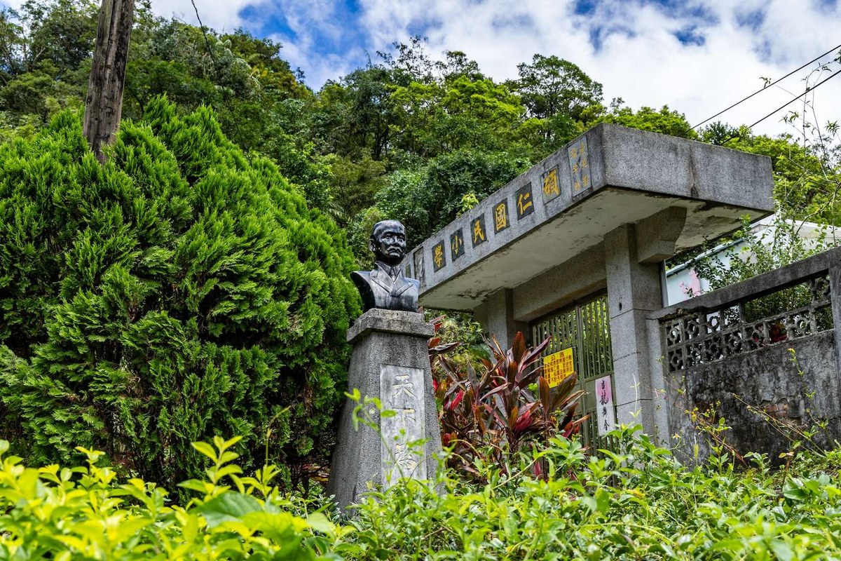
Brick entrance gates of closed Shuoren Elementary School marking the formal Sandiaoling trailhead. · Photo: Wikimedia Commons (CC BY-SA 4.0)
Begin the 2.71 km waterfall climb right outside the shuttered brick gates of Shuoren Elementary School—originally built in 1947 for hundreds of local coal miners' children before mines closed in 1984. Stone stairs climb steadily into dense native makino bamboo groves shaded overhead by towering subtropical flying tree ferns and mountain bird's-nest ferns.
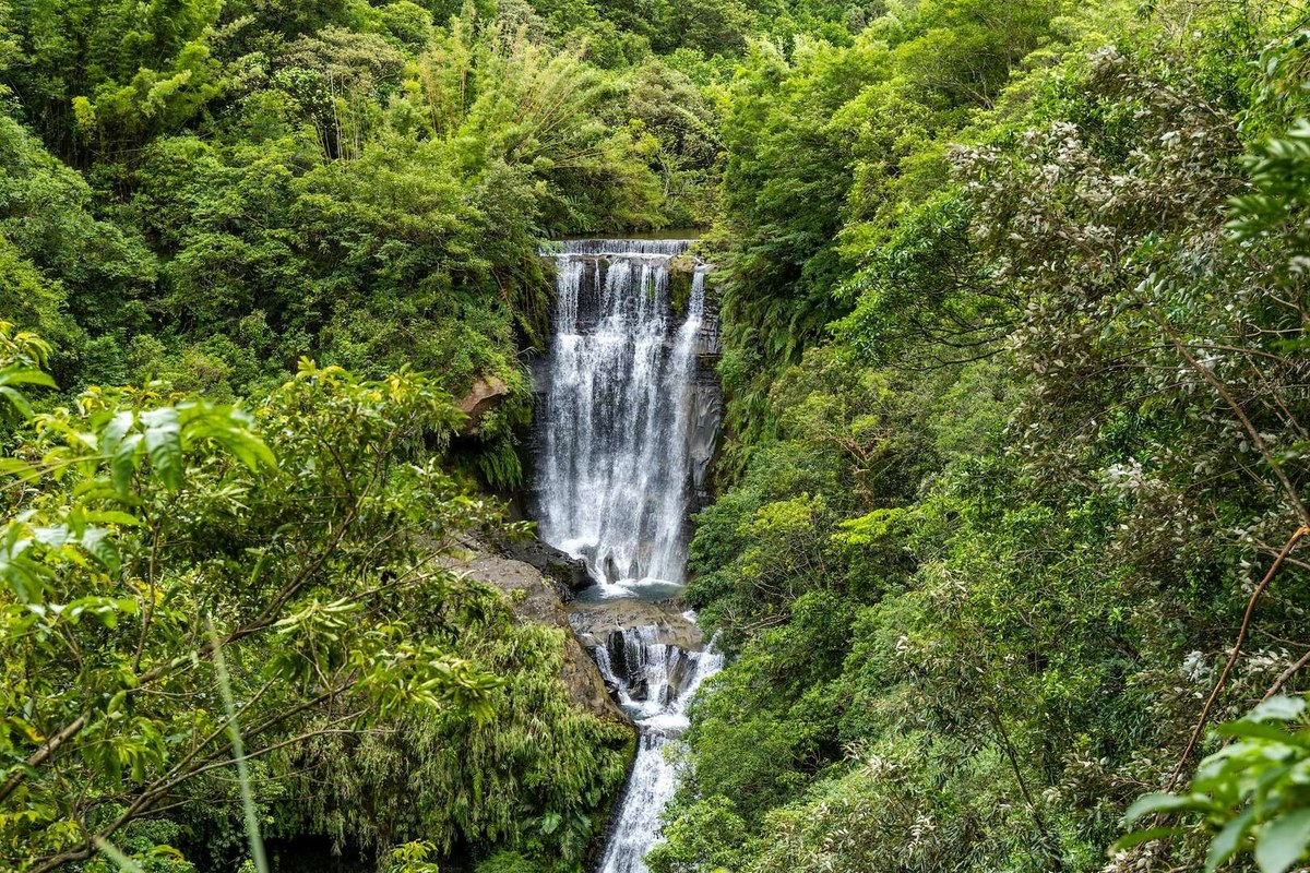
Broad two-tiered drop of Hegu Waterfall framed inside its lush canyon amphitheater. · Photo: Woodford Yang (CC BY 3.0 via Wikimedia Commons)
Reach the first wooden viewing gazebo above Hegu Waterfall (~25–30 m two-tiered drop), the widest and heaviest-flowing cascade where Zhongkeng and Wufenliao streams converge over Daliao sandstone ledges. Nearby down in the neighboring valley corridor sits the separately reserved 1922 Sandiaoling Eco-Friendly Tunnel, whose banyan-draped cut-stone arch portal exemplifies early Japanese colonial railway engineering.
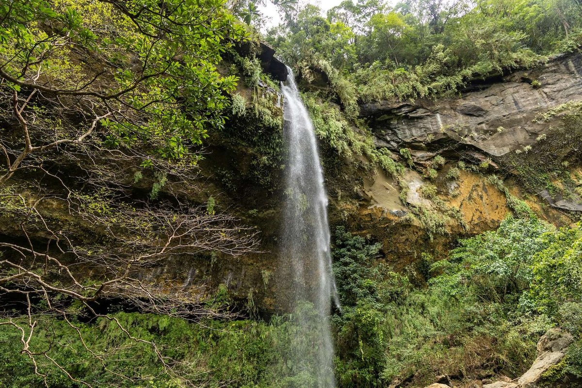
Tall 41-meter drop of Motian Waterfall pouring past its recessed sandstone cave overhang. · Photo: Wikimedia Commons (CC BY 3.0)
Cross two swaying single-file cable-and-wire suspension spans over clear sandstone pothole streams before stepping directly into the shadowed cave overhang behind Motian Waterfall (~41 meters tall). Known locally as "Half Moon Cave" ("Yuemei Cave"), undercutting stream erosion carved a wide rock grotto directly behind the falling white water curtain.
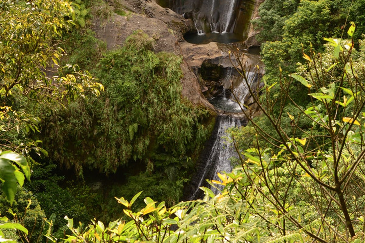
Curved loquat-shaped sandstone grotto framing the 31-meter cascade of Pipadong Waterfall. · Photo: Wikimedia Commons (CC BY 3.0)
Ascend the steep steel rebar ladder and knotted climbing ropes bolted up beside Motian cliff to emerge right onto the crest of Pipadong Waterfall (~31 m drop)—named for its deeply hollowed sandstone amphitheater shaped like a halved loquat fruit. Look across giant upper riverbed potholes before descending cleanly back down toward Sandiaoling trackside cafés (Cafe Hytte or Uncle Kuan's) for wood-fired pizza or espresso before catching the afternoon train to Taipei.
Interactive Location & Route Map
Many rural Asian landmarks don’t appear when searching English spellings in Google Maps. Click any numbered stop on the map below or tap the button above to open the exact latitude/longitude pin on your phone.
Frequently Asked Questions
What is the best direction to hike Sandiaoling Waterfall Trail without a car?
Always take a TRA Local Train to Sandiaoling Station and hike UPWARD through Hegu -> Motian -> Pipadong! Climbing up the steep ~70-degree steel rebar ladder toward Pipadong Waterfall is far easier and safer than climbing down backward with a daypack if starting from the Wufenliao/Dahua ridge end. Simply turn around at Motian if uncomfortable with cliff ladders.
Is the nearby 1922 Sandiaoling Eco-Tunnel part of the waterfall trail, and does it require booking?
No—they sit on separate trail networks, and both are completely free! The Sandiaoling Waterfall Trail behind old Shuoren School requires NO permit and stays open daily. By contrast, walking or cycling through the repurposed 1922 Old Sandiaoling Railway Tunnel ("Sandiaoling Eco-Friendly Tunnel" / The Dark Line) requires reserving a free timed entry slot days ahead on the New Taipei City portal.
Field Verification & Non-Sponsored Standards
This travel dispatch was researched exclusively through public transport (trains, local branch buses, ferries) and foot exploration. Uncharted Asia accepts zero commercial sponsorships, free stays, or sponsored meals. Timetables, fare gates, and mountain trail conditions are independently verified against physical operator timetables. Learn more in our Editorial Methodology.