Taipingshan Jianqing Historic Trail: Taiwan’s Moss-Draped 1915 Logging Railway
Walk a flat 900-meter stretch of abandoned 1915 logging railway lined with mossy timber trestles, cedar forest shadows, and afternoon Pacific cloud banks above Lanyang Valley.
Field Warnings & Critical Traps to Avoid
Strict 23.1K no-parking enforcement, afternoon whiteouts, and sparse weekday buses.
No Parking Permitted at the 23.1K Trailhead Roadside
Roadway curves around the 23.1K entrance lack parking shoulders and are actively patrolled. Drive 1.3 km uphill to the dedicated 24.4K Jianqing Parking Lot and walk the separated pedestrian path back down to the entrance.
Afternoon Clouds Routinely Drop Visibility Below 15 Meters
Moist Pacific air rises smoothly up the Lanyang River funnel every afternoon, enveloping this 1,930 m ridge in dense fog after 13:00–14:00. Visit before 09:00 AM for clear ridgeline panoramas and pack warm rainwear plus fog-driving caution.
Single 14:30 Return Bus & Reservation-Only 1750A Weekday Rules
Kuo-Kuang 1750A (weekdays) cannot be boarded with EasyCard walk-ups—pre-book assigned seats via Kuo-Kuang's app or counter. There is only one daily return coach leaving Taipingshan Villa at 14:30 (passing Jianqing area shortly after; verify exact stop rules with driver).
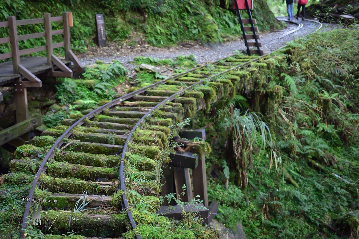
Built at approximately 1,930 meters along Taipingshan National Forest Recreation Area’s main spine in Yilan, Jianqing Historic Trail (見晴懷古步道) preserves a flat 900-meter out-and-back segment of the 1915 Jianqing logging railway. Because early narrow-gauge timber locomotives required grades below two percent, the preserved path tracks mountain contours almost effortlessly past moss-blanketed wooden trestles, steel rails gripped by wild alpine ferns, twin wire-rope canyon crossings, and cold cliffside groundwater cascades.
Drivers must bypass the red-curbed 23.1K entrance bend (strictly patrolled for zero roadside stopping) and pull into the 24.4K Jianqing Parking Lot 1.3 km uphill, following the separated pedestrian boardwalk ~20 minutes down to the trailhead. Public transit relies on Kuo-Kuang Bus: weekend Route 1750 accepts EasyCard/iPASS, whereas weekday Route 1750A requires advance seat reservations and does not accept IC cards. Both depart early morning from Yilan (07:40, 243 TWD) and Luodong (08:00, 215 TWD) with a single 14:30 afternoon departure back down from Taipingshan Villa.
Walk before 09:00 AM for the best chance of glimpsing the distant Holy Ridgeline across the Lanyang Valley before convective Pacific fog blanks visibility after noon. Never step onto slick mossy steel rails or decayed sleepers, and consider pairing your morning trail walk with either Taipingshan Villa’s 180 TWD Bong Bong Train, private-car drives out to fog-draped Cueifong Lake, or a relaxing stop past Jiuzhize Hot Springs at the 4.3K descent marker.
Step-by-Step Visual Route & Timestamps
Follow our exact on-the-ground walking pace and timestamps. Click any photo or stop title to open rich multi-photo galleries, field tips, and expanded logistical guides.
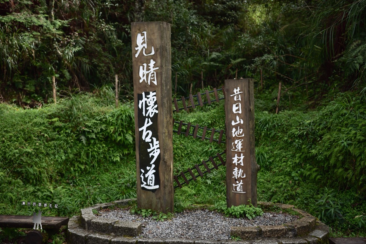
Twin wooden trailhead markers at 23.1K introducing the 1915 Jianqing logging railway corridor. · Photo: Taipingshan Visitor Archive (Field Photography)
Begin beneath the tall weathered cedar entrance pillars inscribed "Jianqing Historic Trail" and "Former Mountain Logging Railway." Originally laid around 1915 as the 5.5 km Jianqing timber line, the preserved 900-meter trail keeps a steady contour alignment where ferns and thick mosses have grown tightly across rusted iron rails.
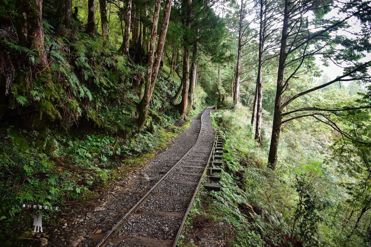
Gravel walking path following preserved narrow-gauge logging rails beside a mossy fern-covered hillside. · Photo: Taipingshan Visitor Archive (Field Photography)
Further along the quiet corridor, the gravel walk hugs preserved railway ballast past historic trestle spans built directly above rushing hillside streams. Soft bryophyte carpets cling across heavy cedar cross-ties where cold water tumbles beneath the old timber framing.
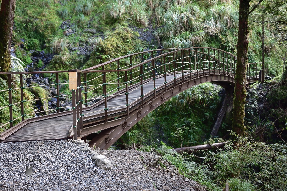
Curved steel arch pedestrian footbridge carrying hikers smoothly above a steep rocky gully on Jianqing Trail. · Photo: Wikimedia Commons (CC BY-SA 4.0)
Cross the graceful brown-painted steel arch footbridge spanning a steep rocky gully partway along the route. Standing mid-span reveals exposed slate hillsides draped in tall alpine silvergrass above the shadowed canyon floor below.
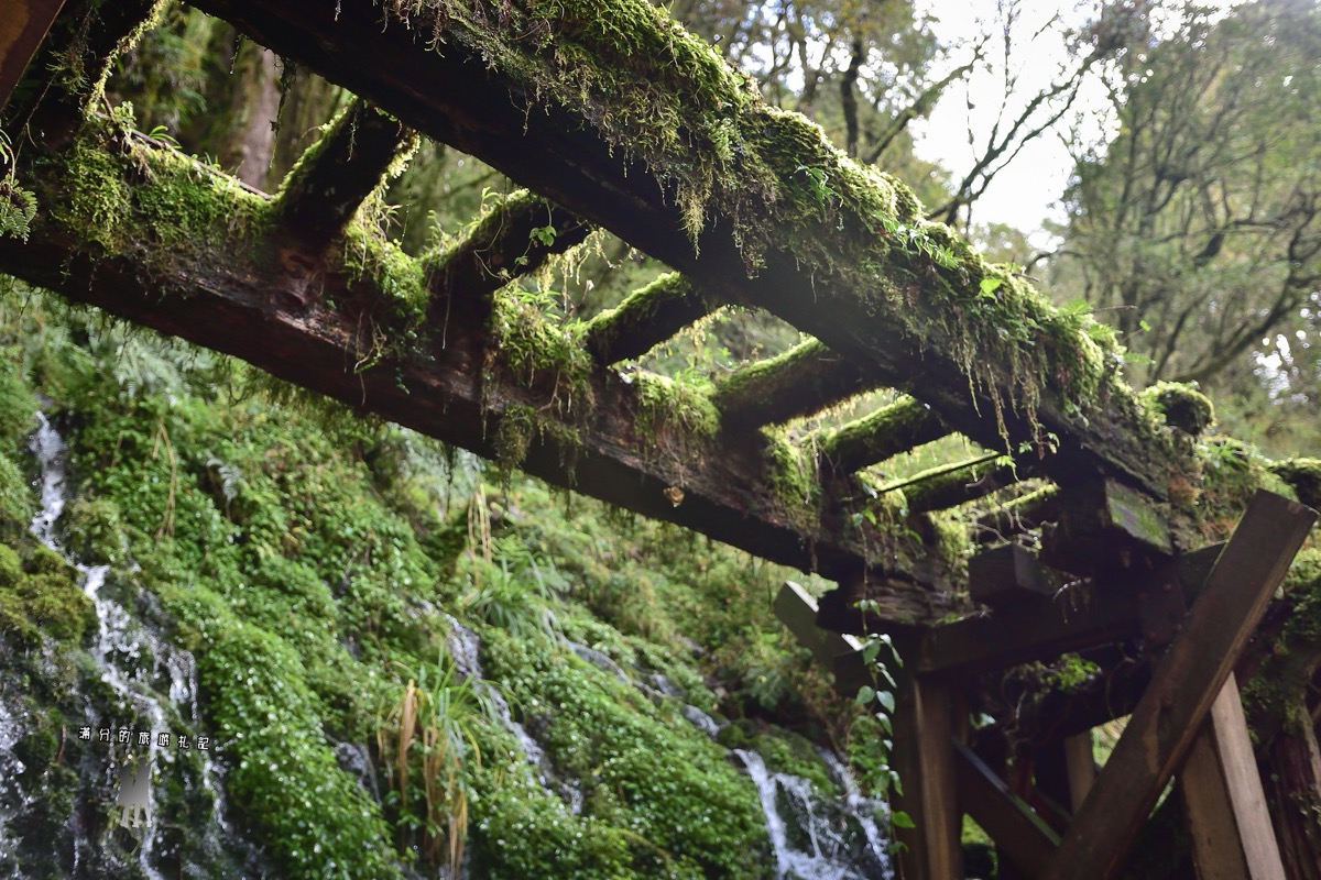
Moss-coated logging railway trestle straddling cool spring cascades near the end of Jianqing Trail. · Photo: Taipingshan Visitor Archive (Field Photography)
Near the maintained 900 m turnaround point, mountain groundwater seeps straight down layered mossy slate cliffs and cascades directly beneath an overhead skeleton of preserved logging timber rails. With extra driving time, continue 16 km northeast along Cueifong Scenic Road to experience Taiwan's largest alpine lake—Cueifong Lake—wrapped in misty mossy cypress woodlands.
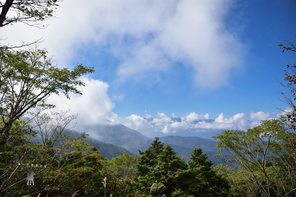
Layered green Yilan mountain ridges beneath rising white cloud banks seen from upper Yizhuan Line 1 lookouts. · Photo: Taipingshan Visitor Archive (Field Photography)
Pause along clear roadside ridge lookouts along Yizhuan Line 1 to watch cumulus clouds drift over distant Lanyang peaks, before continuing your park loop either uphill to Taipingshan Villa (Primeval Forest Park and 180 TWD Bong Bong Train) or downhill past Jiuzhize's steaming geothermal river gorge on your return toward Datong.
Interactive Location & Route Map
Many rural Asian landmarks don’t appear when searching English spellings in Google Maps. Click any numbered stop on the map below or tap the button above to open the exact latitude/longitude pin on your phone.
Frequently Asked Questions
What is the difference between Kuo-Kuang Bus 1750 and 1750A to Taipingshan?
Route 1750 runs on weekends/holidays and supports EasyCard/iPASS payments, whereas weekday Route 1750A requires advance seat reservations and does NOT accept IC cards. Both depart early morning from Yilan (07:40, 243 TWD) and Luodong (08:00, 215 TWD), with a single daily return bus departing Taipingshan Villa at 14:30.
Where must drivers park for Jianqing Historic Trail, and how long is the open route?
Stopping or parking at the 23.1K trailhead bend is strictly prohibited. Park at the dedicated 24.4K Jianqing Parking Lot and walk ~1.3 km back along the safe pedestrian boardwalk to the entrance. Although the historic rail line spanned 5.5 km, landslides restrict the current open, level trail to the preserved 900-meter out-and-back section (1,800 m round trip).
Field Verification & Non-Sponsored Standards
This travel dispatch was researched exclusively through public transport (trains, local branch buses, ferries) and foot exploration. Uncharted Asia accepts zero commercial sponsorships, free stays, or sponsored meals. Timetables, fare gates, and mountain trail conditions are independently verified against physical operator timetables. Learn more in our Editorial Methodology.