Caoling Historic Trail: Qing Dynasty Steles, Silver Grass & Turtle Island Views
Walk the preserved 8.5-kilometer Danlan mountain pass between New Taipei and Yilan to inspect General Liu Ming-teng’s twin 1867 steles and look out over Turtle Island off Dali coast.
Field Warnings & Critical Traps to Avoid
High Yakou saddle wind gusts, punishing Dali knee descent, and hourly local trains.
Fierce Wind Tunnel Gusts Over Exposed Caoling Yakou Pass
Because the Caoling pass carves a narrow notch straight across the Xueshan spur ridge, ocean winds accelerate violently between the hills. Pack a windproof shell jacket, clip hats down securely, and avoid standing too near exposed grassy drop-offs in storms.
Sustained 300-Meter Downhill Stairway Into Dali Station
After enjoying a mild climb from Yuanwangkeng, hikers descend roughly 300 vertical meters of uneven granite stairs plus stone-paved switchbacks straight down to Dali Tiangong Temple. Pack trekking poles or knee braces.
Local Trains Only (~Once Hourly) Serve Rural Dali Station
Express trains bypass tiny Dali Station. Always inspect exact northbound Local train departures before starting downhill from Yakou so you do not wait an hour beside breezy platforms.
Long before coastal railways and mountain highway tunnels linked Taipei to the Yilan plain, couriers, farmers, and Qing soldiers hiked across Caoling Historic Trail—the preserved 8.5-kilometer mountain pass forming the northern backbone of Taiwan’s historic Danlan Old Trail system pioneered in 1807. Taking roughly 3.5 to 4.5 hours point-to-point from Fulong Station to Dali Station, this car-free thru-hike combines living 19th-century calligraphy monuments with one of northern Taiwan’s widest ocean horizon reveals.
To save energy on the flat 2.8 km (~45–50 minute) road walk between Fulong Railway Station and Yuanwangkeng Hydrophilic Park, pick up a classic boxed Fulong Bento by the station and ride a quick taxi (~150 TWD) or November seasonal shuttle directly to the trail entrance. Climbing gradually through subtropical trees past the 1867 Xiongzhen Manyan (“Subdue Wild Mists”) Boulder, woodland canopy falls away completely near the cursive Tiger Stele—where wind-tolerant silver miscanthus grass takes over each autumn throughout November.
Minutes beyond the Tiger Stele lies the dramatic Yakou Wind Gap, marking the border crest directly above the curving black coastline of Dali and offshore volcanic Turtle Island (Guishan Island). Pack a windbreaker for strong ocean gales across the pass, bring trekking poles (or take the gentler concrete Forestry Station switchbacks) to ease the 300-meter downhill stair plunge into Dali Tiangong Temple, and check hourly Local train departures ahead at rural Dali Station before ending your hike.
Step-by-Step Visual Route & Timestamps
Follow our exact on-the-ground walking pace and timestamps. Click any photo or stop title to open rich multi-photo galleries, field tips, and expanded logistical guides.
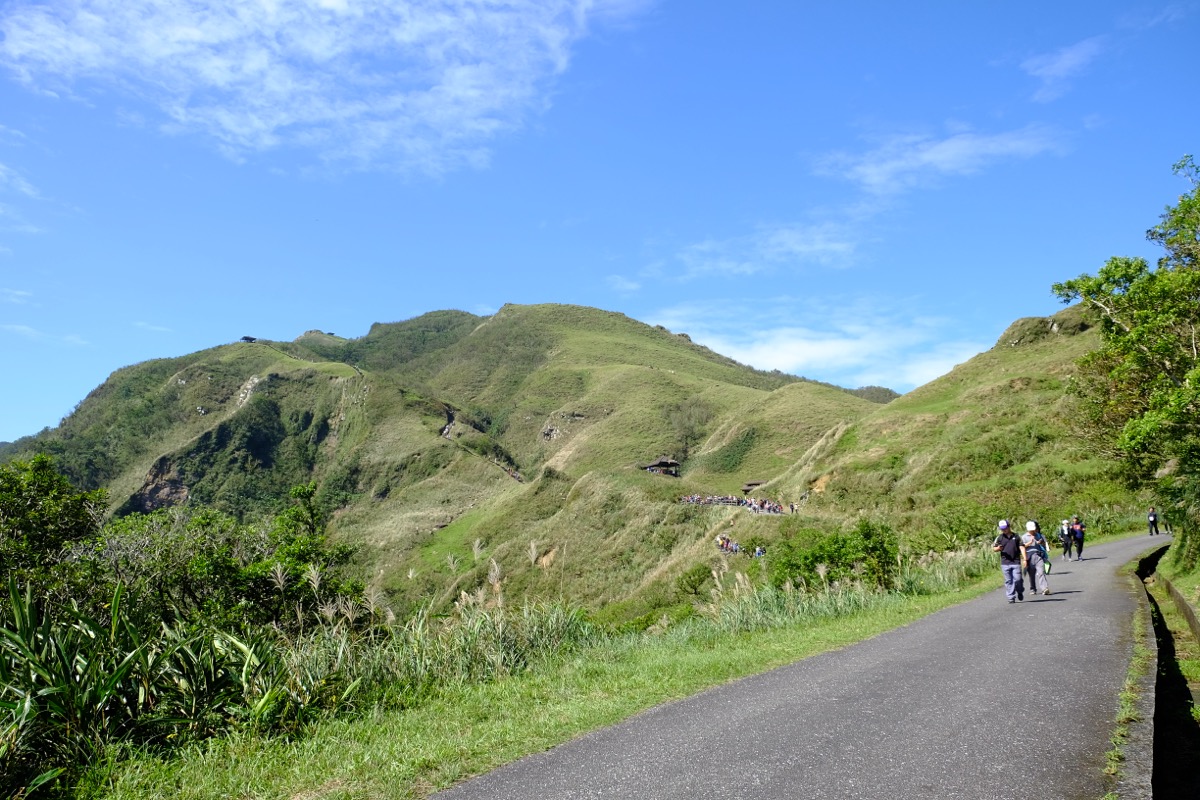
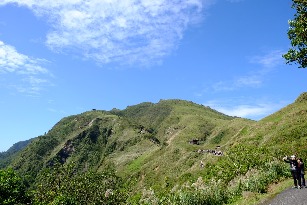
Open grassy hillside path ascending steadily beneath blue coastal skies toward Caoling ridge pavilions. · Photo: Wikimedia Commons (CC BY-SA 4.0)
From Fulong Station, cross Yuanwangkeng Creek (2.8 km road walk or short shuttle/taxi) to inspect the stone-mounted Caoling Historic Trail route map plaque before climbing gently out of wooded creek valleys onto rolling green ridge paths leading toward Yakou's distant pavilions.
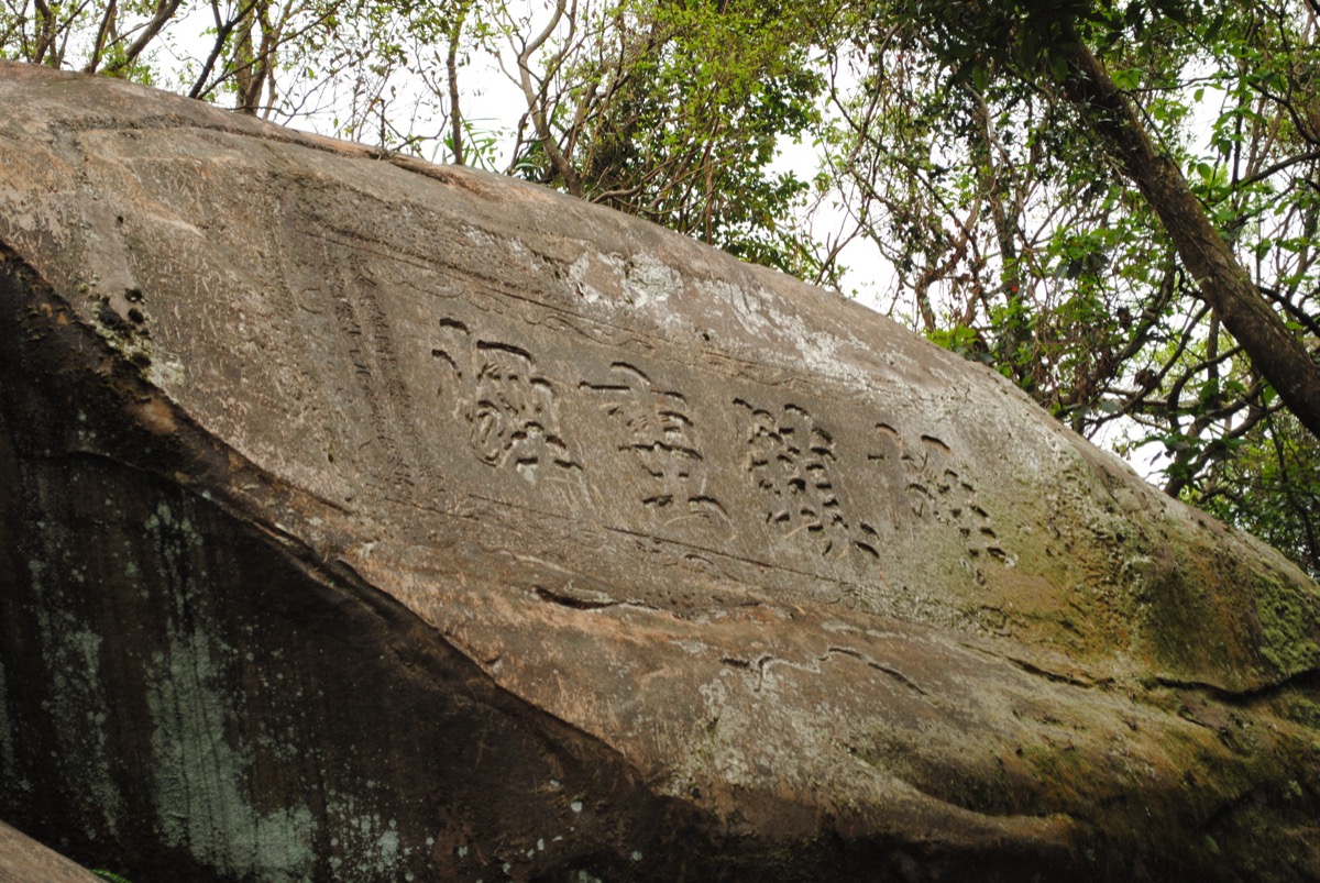
Four carved characters of the 1867 Xiongzhen Manyan boulder monument shrouded in woodland moss. · Photo: Wikimedia Commons (CC BY-SA 4.0)
As the trail climbs upward toward the mountain gap, inspect two National Historic Monuments inscribed in autumn 1867 by Taiwan Garrison Commander Liu Ming-teng: first the bold four-character Xiongzhen Manyan ("Subdue Wild Mists") carved into a colossal forest boulder, followed higher amid silver miscanthus slopes by his single-character cursive Tiger Stele meant to tame fierce ocean winds.
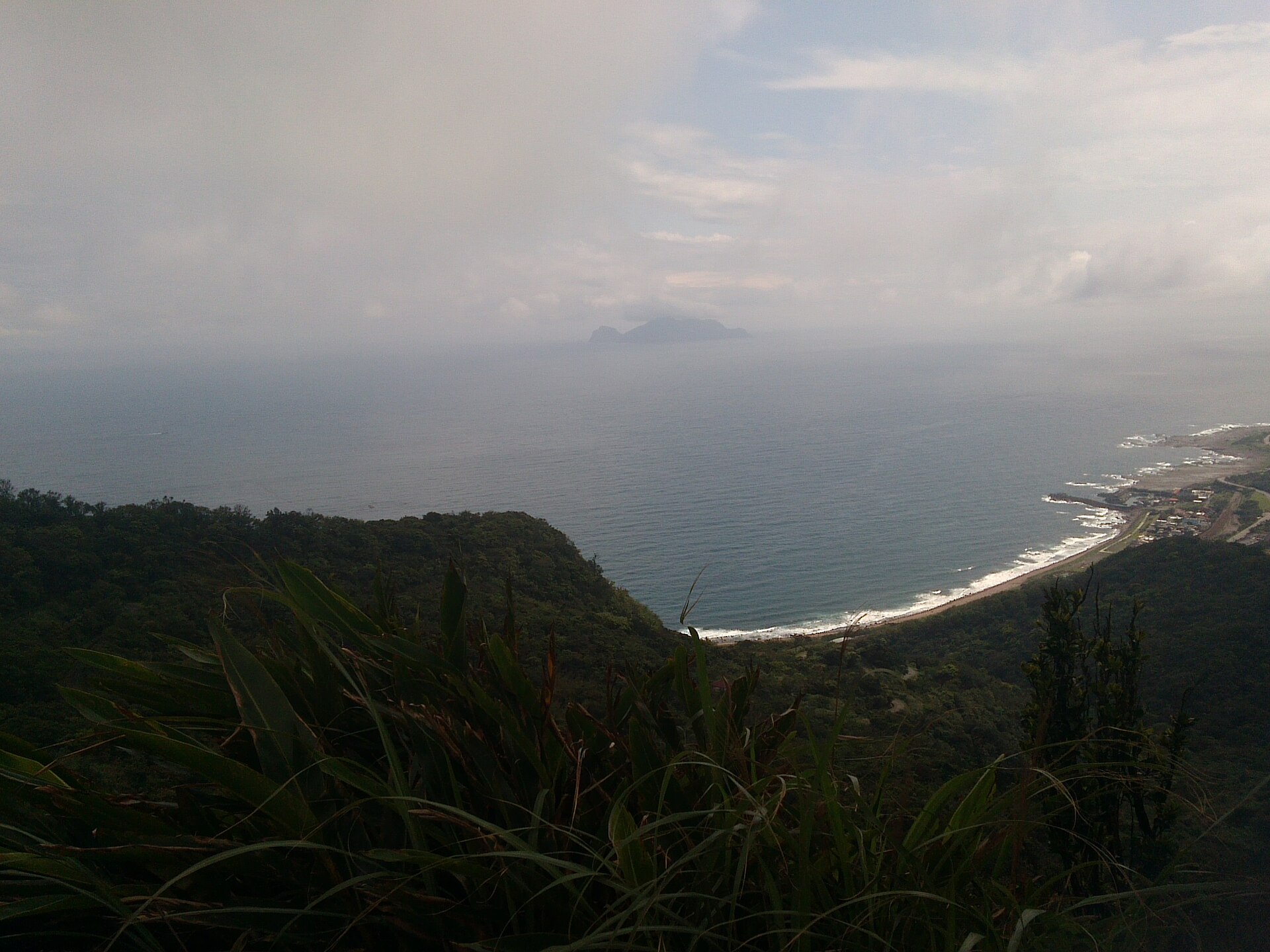
Pacific horizon, volcanic Turtle Island, and the curving Dali coastline seen from the Caoling Yakou saddle. · Photo: Wikimedia Commons (CC BY-SA 4.0)
Step through the stone wind gap at Yakou onto the elevated viewing crest marking the border between New Taipei and Yilan. Suddenly, the full eastern seaboard drops beneath your feet—tracing the curving black-rock beach and railroad line at Dali harbor straight toward volcanic Turtle Island floating across the Pacific.
Interactive Location & Route Map
Many rural Asian landmarks don’t appear when searching English spellings in Google Maps. Click any numbered stop on the map below or tap the button above to open the exact latitude/longitude pin on your phone.
Frequently Asked Questions
Should I hike from Fulong to Dali or reverse from Dali to Fulong?
Hiking Fulong -> Dali is the classic direction for good reason: the ascent from Yuanwangkeng rises gradually through shady forest before culminating in a dramatic ocean reveal at Yakou pass. Climbing steeply up the exposed concrete switchbacks and stairs from Dali first is far hotter and harder on the lungs, though gentler on downhill knees.
What is the best month for silver grass blooms, and how should I get from Fulong Station to the trailhead?
Miscanthus blooms typically peak throughout November (roughly late October to early December). Note that walking from Fulong Station directly to Yuanwangkeng Park covers ~2.8 km (45–50 minutes on flat road) before the mountain trail even starts—take a ~150 TWD taxi or seasonal Tourist Shuttle to save time and energy.
Field Verification & Non-Sponsored Standards
This travel dispatch was researched exclusively through public transport (trains, local branch buses, ferries) and foot exploration. Uncharted Asia accepts zero commercial sponsorships, free stays, or sponsored meals. Timetables, fare gates, and mountain trail conditions are independently verified against physical operator timetables. Learn more in our Editorial Methodology.