Ma Pi Leng Pass & Tu San Canyon: High Limestone Cliffs Above the Nho Que River
Follow the historic Road of Happiness across Vietnam’s Dong Van Karst Plateau, gaze down 800-meter limestone chasms at Tu San Canyon, glide between sheer cliff walls on the Nho Que River, and pause at Dong Van Old Quarter.
Field Warnings & Critical Traps to Avoid
Steep unguarded cliff trails, winter zero-visibility fog, and extreme Nho Que dock slopes.
Steep Unfenced Mountain Cliffs Along Highway QL4C & Skywalk
National Highway QL4C winds past vertical canyon drops with loose sand, freight trucks, and slick rainy-season stretches, while the Ma Pi Leng Skywalk footpath has zero railings. Foreign travelers also legally require a valid home license + 1968 Convention International Driving Permit (IDP) for motorcycles in Vietnam—booking an experienced Easy Rider removes risk entirely.
Dense Winter Cloud Inversions Blank Out Tu San Canyon (December–February)
During cool winter cold fronts from December through February, thick clouds frequently blanket Dong Van and Ma Pi Leng pass for days at a time with temperatures dipping near 5–8°C. Pack thermal rain gear and monitor seasonal daylight forecasts.
Extreme 20–30% Gradient Access Down to Nho Que River Boat Pier
Access roads dropping from the highway down to the Nho Que dock carry punishing ~20–30% hairpin grades. Current pier operations require using regulated electric shuttle vans or experienced local motorbike riders—do not attempt riding rental scooters down or walking uphill in midday heat.
Cutting straight across northern Vietnam’s Dong Van Karst Plateau UNESCO Global Geopark, Ma Pi Leng Pass tracks the dizzying high cliffs of Highway QL4C—historically nicknamed the “Road of Happiness” after tens of thousands of young laborers carved its 20-kilometer stone ledge by hand between 1959 and 1965. Directly beneath the pass lies Tu San Canyon (Hẻm Tu Sản), Southeast Asia’s deepest tectonic river gorge, dropping 700 to 800 meters vertically toward the winding Nho Que River, which is fed by humid mountain watersheds across the Yunnan frontier.
Take a 6-hour sleeper bus or limousine van north from Hanoi to Ha Giang City, where hostels effortlessly arrange the mandatory ~230,000 VND (~10 USD) frontier travel permit using your passport. Unless you possess both a valid 1968 Convention International Driving Permit and seasoned steep-mountain manual riding skills, book an experienced local Easy Rider guide or private car rather than riding blind gravel switchbacks yourself. September–November delivers crisp skies and buckwheat blossoms, whereas December–February cold inversions frequently shroud the gorge completely in mist.
Time highway stops cleanly: photograph the main Ma Pi Leng Pass Monument and walk strictly on foot along the unrailed White Cliff contour trail (~1.5 m clear of crumbling cliff drops) in bright morning light; transfer down the steep Xín Cái or Tà Làng pier shuttles for a 45-to-60-minute Nho Que motorboat cruise through Tu San Canyon (~120,000–150,000 VND combined); explore Hmong rammed-earth nhà trình tường hamlets with mortar-free dry-stone walls; and unwind beneath the cliffs inside Dong Van Old Quarter’s century-old brick-and-yellow-clay Phố Cổ Café over Shan Tuyet wild mountain tea ahead of Sunday morning market crowds.
Step-by-Step Visual Route & Timestamps
Follow our exact on-the-ground walking pace and timestamps. Click any photo or stop title to open rich multi-photo galleries, field tips, and expanded logistical guides.
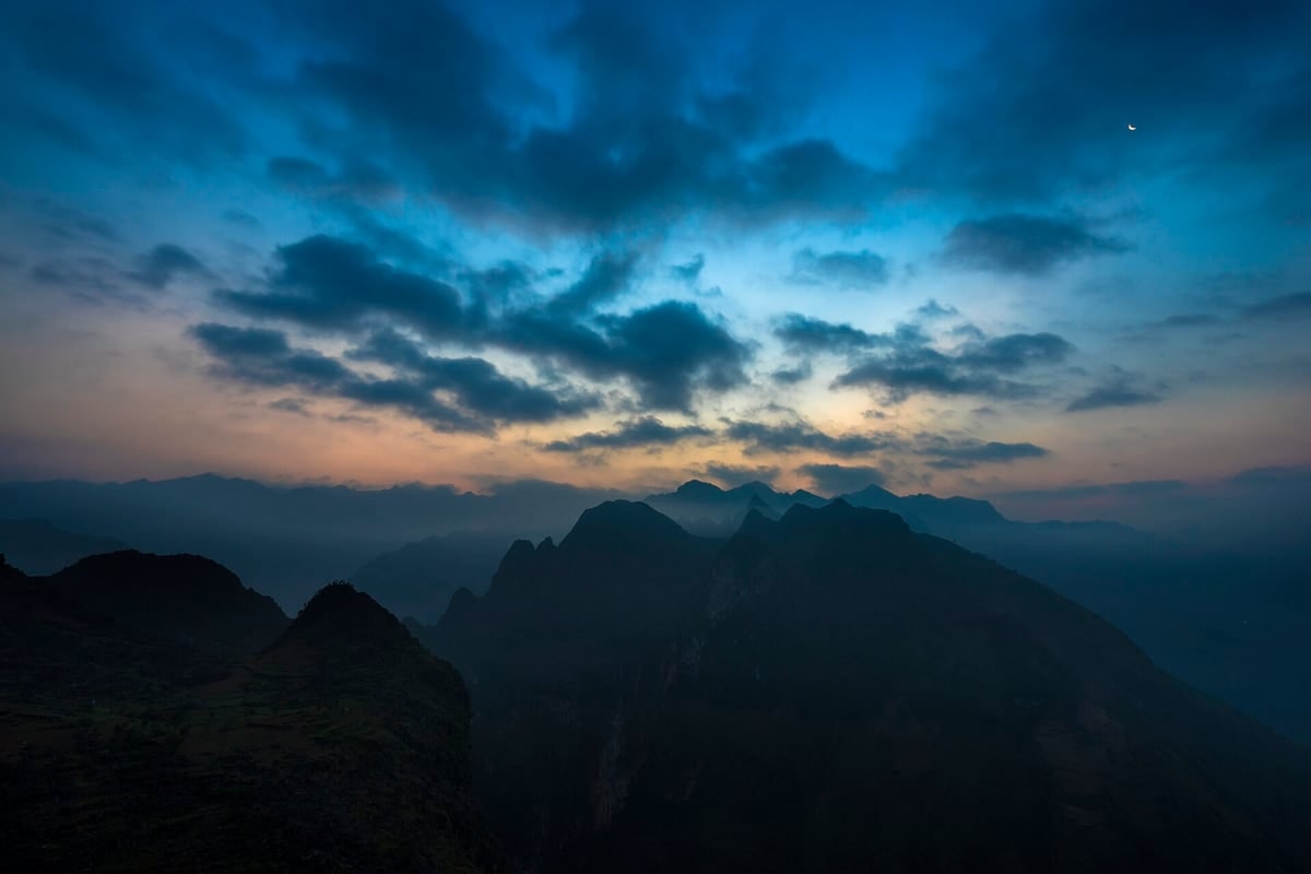
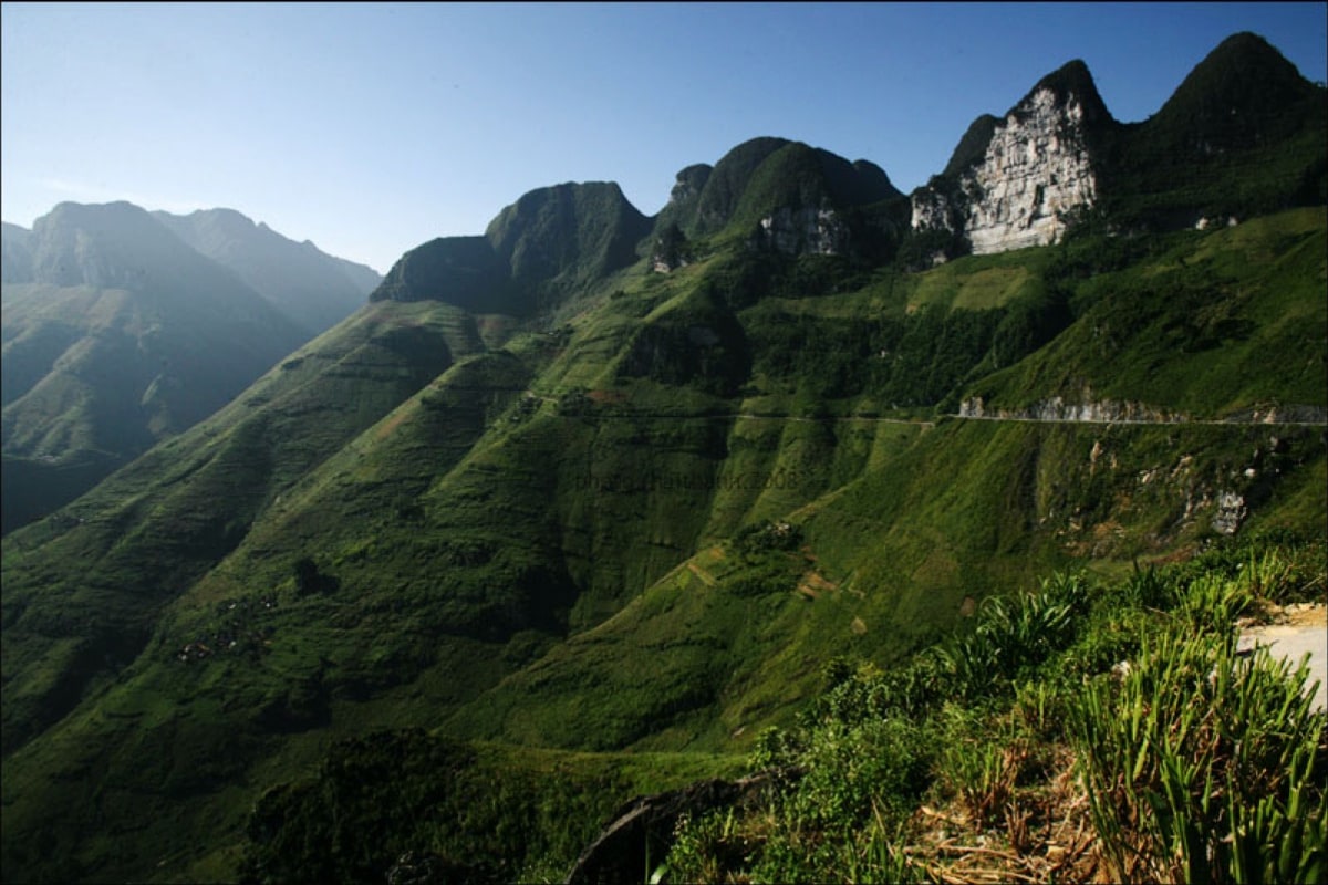
Switchbacking Road of Happiness (QL4C) blasted horizontally into steep karst cliff faces at Ma Pi Leng. · Photo: Wikimedia Commons (CC BY-SA 4.0)
Follow National Highway QL4C between Dong Van and Meo Vac along the 20 km crown section of the "Road of Happiness," excavated by hand by tens of thousands of young volunteers between 1959 and 1965 along sheer karst walls. Pause beside the Youth Volunteer monument to view the limestone fold plunging vertically into the green Nho Que River far below.
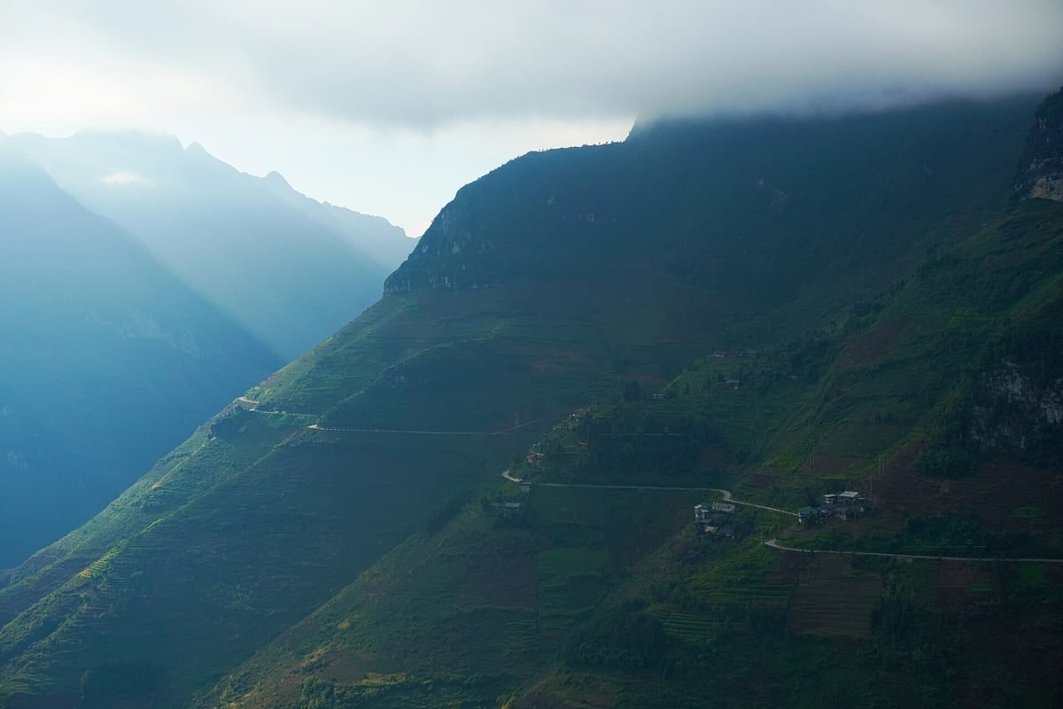
High contour footpath tracing steep limestone ledges high above the Nho Que River channel. · Photo: Wikimedia Commons (CC BY-SA 4.0)
Leave asphalt traffic behind along the narrow contour footpath running high along the white limestone cliff edge ("Skywalk" / White Cliff Trail) above the pass. Carved originally as a hillside mountain track connecting highland hamlets, the dirt-and-stone spur leads to wide rocky ledges hovering dramatically over the Nho Que canyon curve.
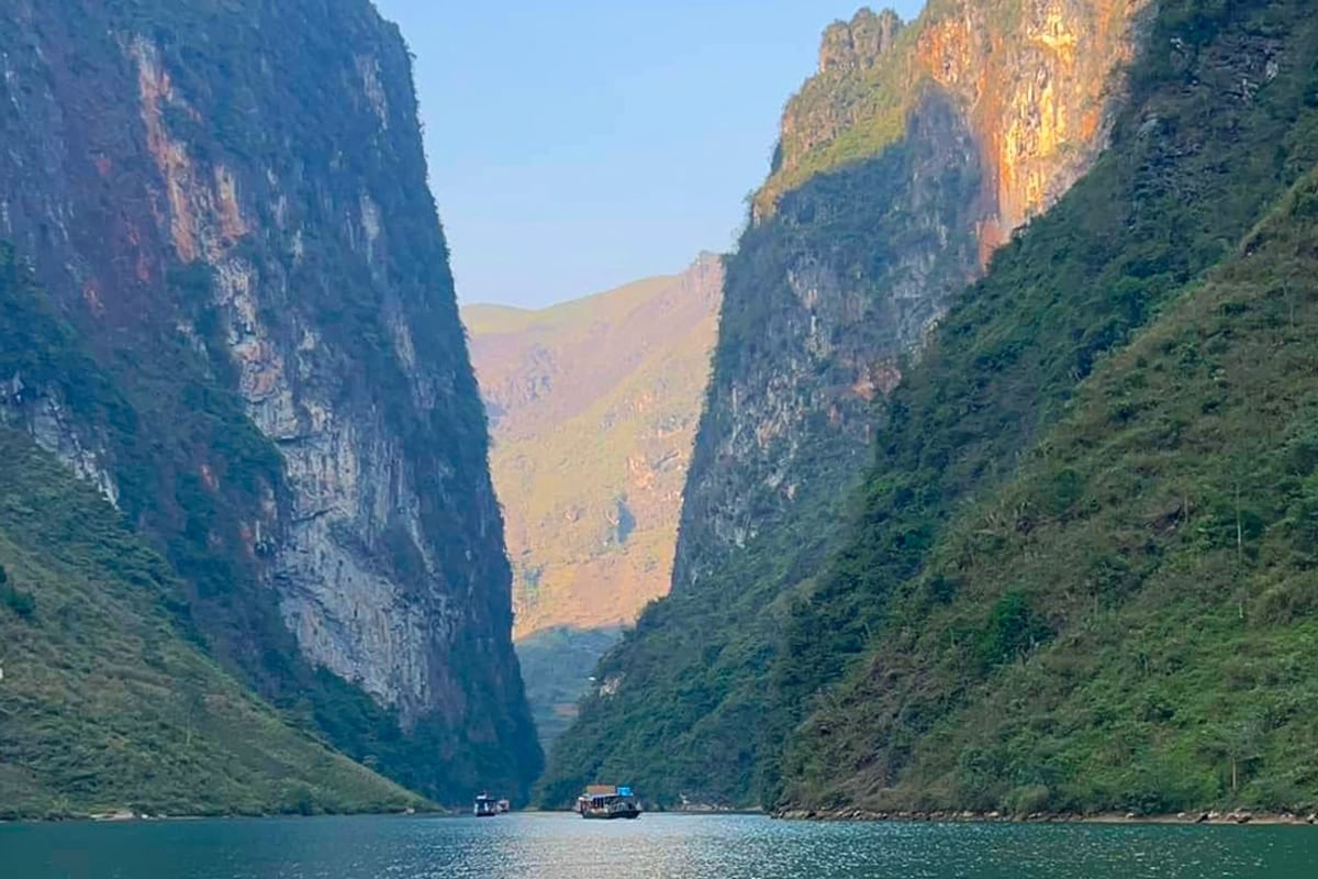
Motorboat sailing along the Nho Que River straight between towering vertical walls of Tu San Canyon. · Photo: Wikimedia Commons (CC BY-SA 4.0)
Ride an authorized pier shuttle bus or local taxi bike down from the high ridge to the Ta Lang / Xín Cái reservoir landing, boarding quiet motorboats through Tu San Abyss (Hẻm Tu Sản). Carved over geological ages where Nho Que River cuts straight through uplifted Dong Van limestone strata, 700-to-800-meter stone cliffs tower overhead while framing calm waters below.
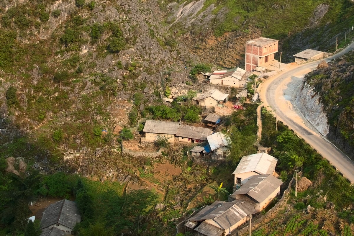
Rammed-earth Hmong farmhouse ringed by dry-stacked limestone fences amid highland corn patches. · Photo: Wikimedia Commons (CC BY-SA 4.0)
Explore quiet rural Hmong hamlets tucked amid rugged karst sinks between Meo Vac and Dong Van (such as Lao Xa or Lung Cam communities). Families build thick mud-brick "nha trinh tuong" cottages roofed in dark clay yin-yang tiles, enclosed within mortar-free limestone dry-stone fences beside pocket-sized hillside corn plots.
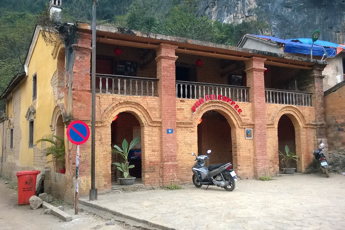
Century-old two-story brick-and-clay arcade of Pho Co Coffee beneath steep karst walls in Dong Van Old Quarter. · Photo: Wikimedia Commons (CC BY-SA 4.0)
Conclude the highland crossing back in Dong Van Ancient Quarter ("Phố Cổ Đồng Văn"). Built roughly a century ago beneath sheer limestone peaks, its yellow clay-walled colonnades and terracotta brick arches—including the landmark Phố Cổ Coffee terrace (#02 Đồng Văn)—offer shelter to warm up over Vietnamese phin coffee or hand-picked Ha Giang Shan Tuyet wild ancient-tree tea as lanterns light the historic courtyard market.
Interactive Location & Route Map
Many rural Asian landmarks don’t appear when searching English spellings in Google Maps. Click any numbered stop on the map below or tap the button above to open the exact latitude/longitude pin on your phone.
Frequently Asked Questions
Do foreign visitors need a border travel permit for Ha Giang & Ma Pi Leng?
Yes. Because northern districts including Dong Van and Meo Vac border southern China, non-Vietnamese travelers must obtain a Frontier Travel Permit (~230,000 VND / ~10 USD). Nearly all guesthouses in Ha Giang City arrange permits effortlessly at check-in using your original passport, or you can apply in ~10 minutes at the Ha Giang Immigration Office.
Is it safe to explore Ma Pi Leng Pass without riding a motorbike myself?
Absolutely—avoid riding yourself unless you hold a proper motorcycle license + 1968 Convention International Driving Permit and years of steep mountain shifting practice. Instead, hire a vetted local "Easy Rider" driver (riding safely as pillion behind a guide who knows every gravel hairpin), join a 4WD car tour, or ride scheduled regional minibuses connecting Ha Giang City, Dong Van, and Meo Vac.
Field Verification & Non-Sponsored Standards
This travel dispatch was researched exclusively through public transport (trains, local branch buses, ferries) and foot exploration. Uncharted Asia accepts zero commercial sponsorships, free stays, or sponsored meals. Timetables, fare gates, and mountain trail conditions are independently verified against physical operator timetables. Learn more in our Editorial Methodology.