Tu Lan Cave System & Tan Hoa: Jungle River Trekking in Rural Quang Binh
Trek limestone river crossings with Oxalis to swim inside active karst tunnels and sleep beside Tu Lan's jungle waterfall in Vietnam's flood-resilient Tan Hoa valley.
Field Warnings & Critical Traps to Avoid
Annual flood-season closure, mandatory drainage footwear, and zero-solo cave access.
Complete Monsoon Flood Closure From Mid-September to Mid-November
Because Tan Hoa sits inside an enclosed karst sinkhole valley without wide river outlets, autumn typhoons regularly submerge roads and cave mouths by 2 to 10+ meters. All Tu Lan caving expeditions close automatically between mid-September and mid-November.
Wear Fast-Draining Jungle Shoes (Avoid Heavy Waterproof Boots)
Trekkers ford waist-deep rivers and swim straight through active river caves multiple times a day. Waterproof Gore-Tex boots trap cold river water inside all day, causing severe blisters—choose quick-drain mesh or canvas trail shoes with deep outsole lugs (Oxalis rents army-style canvas boots locally).
Mandatory Helmets, Life Vests & Certified Cave Guides Inside Tunnels
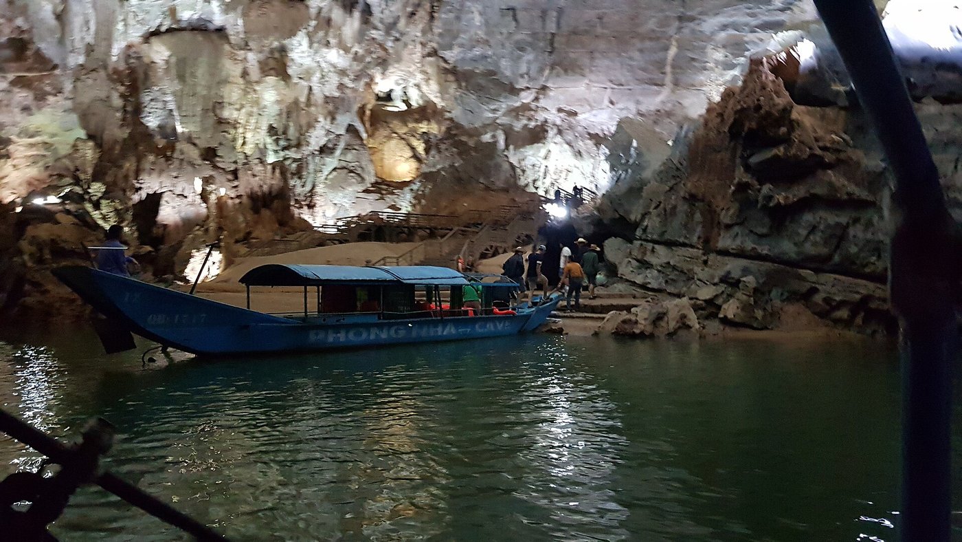
Unlike tourist show caves such as Phong Nha or Paradise Cave, Tu Lan caves lack electric lighting, concrete paths, or metal railings. Entry requires licensed guides, Caving helmets, headlamps, and strict adherence to Leave No Trace camp protocols.
Set roughly 70 kilometers northwest beyond the formal boundaries of Phong Nha-Ke Bang National Park, the rural karst basin of Tan Hoa in Quang Binh Province opens onto Vietnam’s rawest river-caving corridor: the Tu Lan Cave System. While neighboring show caves inside the national park—such as Phong Nha or Paradise Cave (Asia’s longest dry cave)—greet day-trippers with illuminated boardwalks, Tu Lan stays completely unlit, undeveloped, and accessible strictly alongside licensed expedition guides from Oxalis Adventure.
Start early from Tan Hoa’s broad buffalo meadows, home to the indigenous Nguon ethnic community. Because enclosed limestone cliffs delay seasonal drainage during autumn typhoons, locals engineered ingenious amphibious nhà phao (“floating timber houses”) moored to vertical steel guide poles atop buoyant plastic drums—allowing village homes to rise calmly above floodwaters that submerge the valley floor every year. This adaptation and community-owned tourism workforce earned Tan Hoa recognition as a UNWTO Best Tourism Village in 2023.
Trekkers ford waist-deep river bends and swim straight through active subterranean karst passages beneath ancient Paleozoic limestone massifs sculpted over the past 3 million years by underground waters—rendering heavy waterproof boots counterproductive in favor of fast-draining trail or jungle canvas shoes. Observe the mandatory annual flood-season closure from mid-September through mid-November, book your 2D1N expedition (~6.5–7.5 million VND all-inclusive via Dong Hoi VDH transfers) between December and late August, and spend an unforgettable night beneath open cliff skies beside the cascading pools of Tu Lan Waterfall Camp.
Step-by-Step Visual Route & Timestamps
Follow our exact on-the-ground walking pace and timestamps. Click any photo or stop title to open rich multi-photo galleries, field tips, and expanded logistical guides.
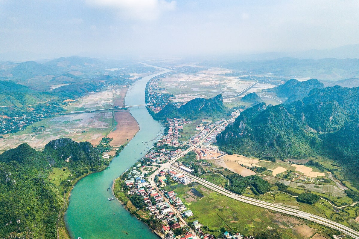
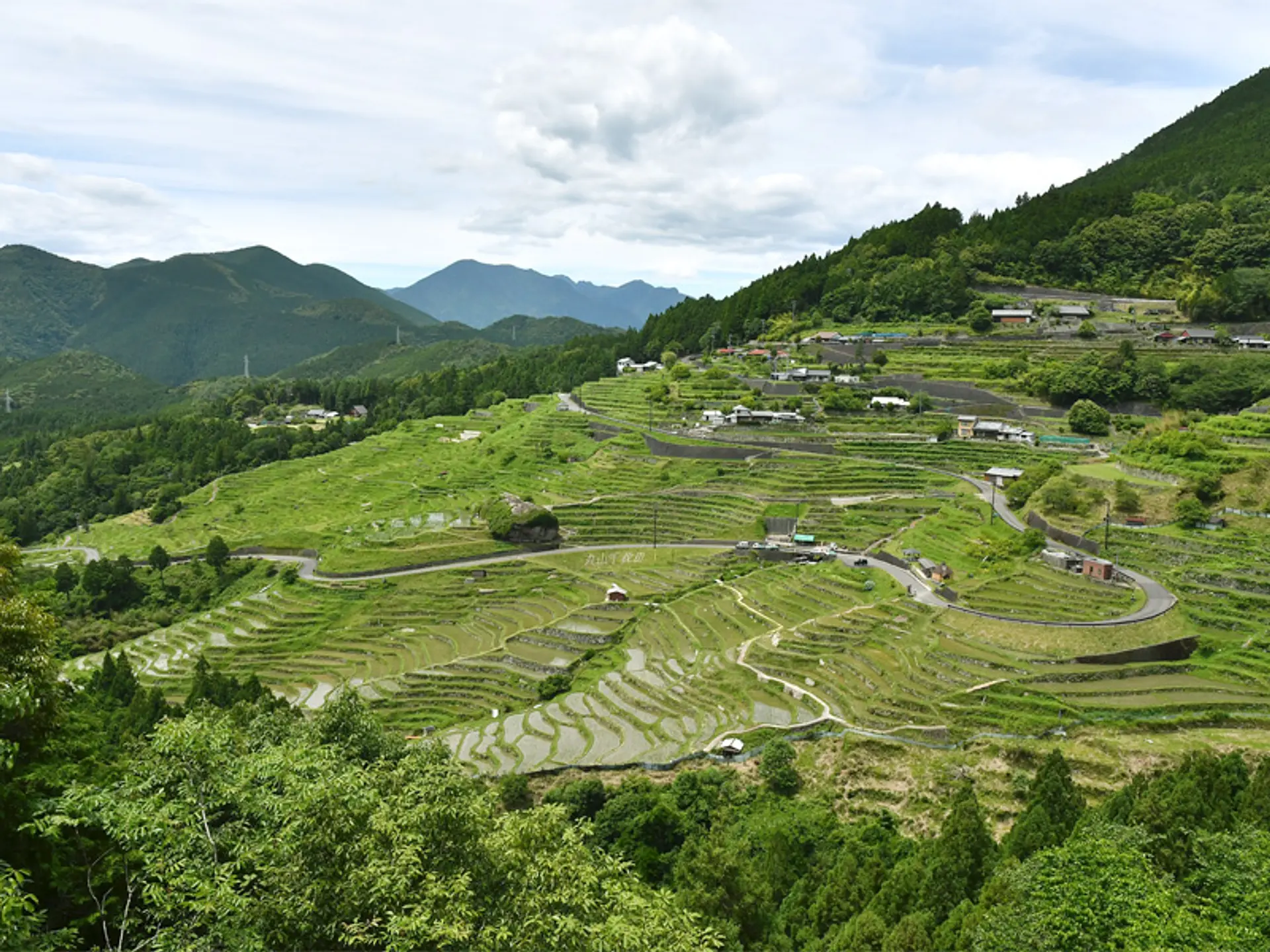
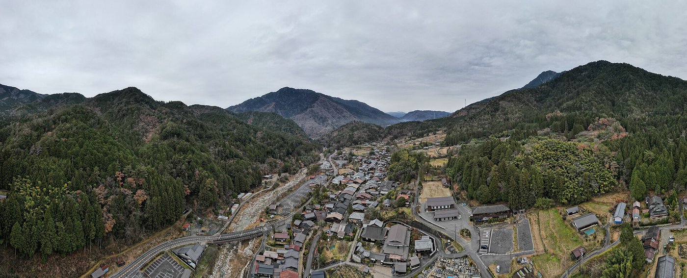
Karst valley meadows and limestone peaks framing the trailhead leaving Tan Hoa Commune. · Photo: Wikimedia Commons (CC BY-SA 4.0)
Begin the morning trek across flat grassy meadows framing Tan Hoa Commune—an enclave situated roughly 70 km northwest outside Phong Nha-Ke Bang National Park. Along the village perimeter stand ingenious floating timber homes crafted by the local Nguon community on sealed plastic barrels anchored between tall guide posts so houses rise cleanly when autumn floods submerge the valley floor.
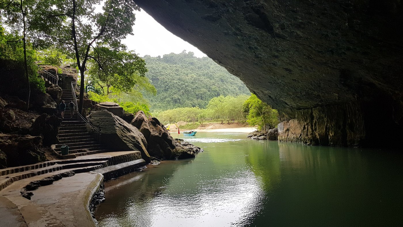
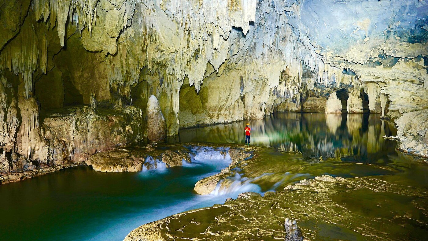
Turquoise subterranean stream winding out beneath the massive limestone arch of Ken Cave. · Photo: Wikimedia Commons (CC BY-SA 4.0)
After scrambling over limestone passes into the valley of Hang Chuot (Rat Cave) and Hang Ton, buckle up life vests and step into turquoise subterranean streams inside Ken Cave and Tu Lan Cave. Your headlamp beam sweeps across scalloped ceilings carved through ancient Permian limestone bedrock as guides lead a cool river swim out into jungle light.
Clear limestone waterfall tumbling into the swimming lagoon beside Tu Lan wilderness camp. · Photo: Wikimedia Commons (CC BY-SA 4.0)
Emerge into the forested amphitheater of Tu Lan Camp, positioned right beside two cascading waterfalls tumbling out of limestone cave walls into deep jade pools. Dry off in shaded jungle hammocks before local cooks prepare wood-fired barbecue skewers, morning glory, and steamed mountain rice for trekkers camping under open jungle cliffs.
Interactive Location & Route Map
Many rural Asian landmarks don’t appear when searching English spellings in Google Maps. Click any numbered stop on the map below or tap the button above to open the exact latitude/longitude pin on your phone.
Frequently Asked Questions
When is the Tu Lan Cave System open, and why does it close every autumn?
No—tours do NOT run year-round. Because autumn monsoons submerge Tan Hoa's enclosed valley under meters of runoff, the Tu Lan Cave System is closed annually from roughly mid-September through mid-November. Operating season runs mid-November to mid-September, with cool dry weather best from December to April and warm swim-friendly weather from May to August.
Is Tu Lan inside Phong Nha-Ke Bang National Park, and can I trek independently?
No on both counts. Tu Lan and Tan Hoa lie roughly 70 kilometers northwest outside the borders of Phong Nha-Ke Bang National Park in Minh Hoa District, and independent unguided caving is strictly forbidden under provincial conservation rules. All itineraries—even 1-day hikes—must be booked through licensed operator Oxalis Adventure.
Field Verification & Non-Sponsored Standards
This travel dispatch was researched exclusively through public transport (trains, local branch buses, ferries) and foot exploration. Uncharted Asia accepts zero commercial sponsorships, free stays, or sponsored meals. Timetables, fare gates, and mountain trail conditions are independently verified against physical operator timetables. Learn more in our Editorial Methodology.